The last two days have been interesting. I am in no way prepared to do any sort of winter sports. Nor do I have the cash to rent a bunch of equipment to do so. I set out around Mammoth and the Lake June Loop to find some hiking spots. Apparently hiking in snow is awesome with the aid of snowshoes. I pull up to a few different trail heads in the area hoping to find a path that won’t make me sink to my waist in snow, but turn up with nothing. Oh well, at least I got to tour a bunch of areas and I got my laundry done while I was in Mammoth. It was definitely needed.
Fern Lake hiking fail…
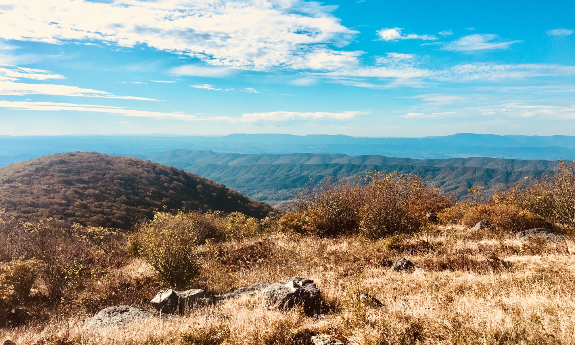
I decide to head back to where I’m camping and hike around Lake June. It’s a beautiful body of water, and is pretty much deserted this time of year. I take my time walking around, hoping to spot a trout in the crystal clear water. No such luck. I’ll be heading to Mono Lake the next day, and I’m excited to see the Calcium carbonate “tufas” that surround the lake.
Lake June walkabout
Created at least 760,000 years ago, Mono Lake is old as shit. At the edge of the Great Basin Desert, it gets about 5″ of precipitation a year. All of it’s other water comes from snow melt or ground water bubbling up. There is no exit for water here… It’s a last stop shop. It either is evaporated away or left in the lake. This causes a very saline condition, about twice that of the Pacific Ocean.
Mono from a distance.
Apparently, water levels dropped drastically when LA started diverting water away for its growing population. Fucking LA….. When water levels dropped like crazy, the islands in the middle of the lake were now connected to the mainland. Who cares, right? Well the 45,000 California Gulls nesting out there cared a lot. Coyotes devastated the ground nesting out there. Along with the gulls, Wilson’s phalaropes and red-necked phalaropes were being harassed by predators while trying to fuel up for their migration south. So, a concerned group of citizens lobbied, and got water re-diverted back to Mono Lake. Big Win! But, with climate change and other human impacts, water levels are dropping again. California having water issues?? You don’t say…
A cool feature about this lake are the Tufa formations around the margin. Calcium carbonate structures that are created when calcium rich ground water hits the saline lake water while bubbling up. They are exposed now due to the drop in lake levels. These things are awesome bird rests, and make good nesting platforms for ospreys. There are no fish in this lake, but they are close enough to other feeding sources that they are still amazing real estate. Most of the birds here are only interested in the alkali flies that are buzzing around the lake shore. They are plentiful, but stay about knee high so they are not bothersome.
TufffaaaaaaOsprey building a nest
Alongside the lake is also a previously underwater volcano that is now above water. As the magma was pushed up, it was cooled by the water, creating long, smooth fissures and cracks in the rock. There was no trail here, just a crazy 4×4 trail and a rock scramble. I was really trying to not fall in a damn crack. That’s what she said…
Volcano Fissure
At the end of the day, I found a random, lonely 4×4 trail that was hidden from other roads, and settled in for the night. This was the first time the stars were actually out and about without disruption from artificial lights, dust, smog or the moon. It was desolate and beautiful. In the morning, I head to South Lake Tahoe for 2 nights, then a weekend getaway in Dallas to see Cas and help her with her mom.
Leaving Death Valley was easy. The temp was only going to be rising, so I’m happy to retreat to a cooler climate at altitude. Death Valley is the second hottest place on the planet, with temps reaching 135. At night in the summer, it rarely dips below 100. I can’t imagine trying to stay in my truck during a night like that… So, I drive north and look for cool places to stop along the way.
Just a pretty road…
The drive out of the valley and into the presence of the Sierra Nevada mountains is amazingly pretty. They are the largest mountains I have ever seen in person, and have a menacing look about them. I pass a few small towns on my way north, and decide to stop in Lone Pine, CA to find the Inyo National Forest visitor center. I’m lucky enough to find a ranger who is willing to go over maps with me, showing where to hike, which roads are closed, and what areas to avoid.
Leaving with a handful of maps (I love maps…) I head north to find the Alabama Hills. It’s a recreation area where they have filmed a bunch of old and recent western movies. Tons of John Wayne films, and Django unchained were filed here. The main road is even called Movie Dr. As I get to the park, I locate Mt. Whitney, the tallest peak in the lower 48 states. It’s only barely taller than its neighbors, but still way the fuck up there. Almost 14,500 feet tall. Driving through the Alabama Hills (which look absolutely nothing like Alabama), I realize I don’t really like it here. Cars are parked everywhere, there are 4×4 paths every few feet… It’s beautiful, don’t get me wrong, but it’s packed with people and the landscape is highly disturbed. Just wasn’t feeling it.
Fake AlabamaAlabama Hills
So I leave the fake Alabama and continue North. I have a reservation at a campground near Lake June, CA. The place I was originally supposed to stay at was closed due to an avalanche warning, so I was relocated to another site. Good looking out Forest Service… So continuing north, I pass the road that would have taken me to see the bristlecone pine trees that I’ve been dying to locate. The road is closed 8 miles before the first grove, and there’s 4 feet of snow on the ground. I don’t want to end up like the Donner party, so I skip this section. Plus I don’t own any snowshoes. Should I get some? What would I do with them in Florida??
Sad day…
The drive is gorgeous. Mountain views shift ever so slightly as your location changes. Always showing a new, more beautiful slope than the one you saw 10 minutes ago. I find myself stopping at all the vistas to take it in. I’m am not experienced with snow or real mountains, so this all seems surreal. I get to one of the trails pointed out to me by the forestry ranger called Tom’s place. The hike is really on a closed road, but the views are amazing. Plus, again, I don’t have snowshoes or skies, and there’s still 4 feet of snow. I take the road hike, and am not disappointed. At 9,200 feet, I think it’s the highest I’ve ever been. Funny to go from -282 feet to 9,200 in one day. As I get back to the truck, I realize the ice in my cooler is totally melted. I do what any normal person would do, and shovel some snow in. Free ice, right?
GPS reading
Free ice!
After my hike, I finally pull up to my campsite, and am greeted by the most friendly ranger at the gate. She happens to be from Amelia Island, small world! As I get settled in, I realize this site is beautiful. There’s Lake June, with beach access and amazing views of the adjacent mountains. I love it. Hoping it doesn’t get too cold while I’m here… Going to explore Mammoth Lakes tomorrow and see what I can get into.
Lake June, where I’m campingIt’s never too cold for Black Labs to go for a swim.
Joshua Tree has been pretty amazing. I spent one additional night there at a campground on the northwest corner of the park. I liked this spot because I had cell phone reception, which was a nice change from the previous areas I had been sleeping. I set up camp in the wrong spot.. One space over. The markers were shit, so I take no blame for my screw up. The rightful owners of the spot I’m in is a lovely couple who were married at Joshua Tree 39 years ago. Holy shit, that’s amazing! Tell me everything! How did the park look? How did you make the marriage work for so long? We talk for a bit, and he gives me some recommendations for hot springs on my path of future travel. As I leave Joshua Tree, I decide to stay on the East side of the Sierra Mountains. This means I’ll miss Kings Canyon and Sequoia and Yosemite National Parks. All the roads are still closed for the season, and snow fall is way above average. I don’t want to risk the driving, and I it gives me an excuse to come back with Cas in the future. I’m disappointed, but I can’t expect to see everything this trip.
Last hike at Joshua Tree, Panorama Trail
As I head out, I set my course for Death Valley National Park. It’s the largest park in the lower 48 states, and has lots of cool things to explore. The drive in was insane with altitude changes. Up, down, 9% grades, windy roads… The reason Death Valley is so damn hot and dry is because its situated behind three mountain ranges. Obviously the Sierras are the largest, causing the main rain shadow, but two other smaller ranges suck out any remaining precipitation that may have hit the valley. It is the hottest, driest, lowest spot in the western hemisphere. I’m a Florida kid, I can handle hot, right?
Mesquite Sand Dunes at Death Valley
As I pull into my campsite, I realize its a big open dirt lot. I guess I should have expected that. It’s a desert with an average rainfall of 2 inches a year. What did you expect, trees? The site is called stovepipe wells, and looks to have about 200 sites, almost all of which are empty. Around the camping area is what appears to be a small town. A resort was built here in the 30s? I can’t remember… But there are hotel rooms, a pool, a restaurant and a saloon. All functional. Anyway, I’m a little rattled from the drive, so I pop into the saloon to get a beer and research what hikes to do. Stepping outside, it legitimately feels like I’m in an oven. The temperature gauge is reading 99.
The original stovepipe well. This was one of the only fresh water sources for early travelers. Sometimes sand would cover it up, so a large pipe was erected so people could find it and dig it out.
After some hiking, I come back to the dirt lot campsite and wait for sunset. Man, this heat is still intense well into the evening. It’s the first time I’ll need to use my portable fan.
I wake up the next morning, and I’m excited. Today I will go to Badwater Basin to see the lowest spot, and do a hunt for places that they filmed Star Wars. Many of the original movies were filmed here, as well as IV and VI. The stovepipe wells resort had free maps telling you where to find filming locations.
282 feet below sea level
Just open and white
Badwater Basin was amazing, it’s hard to capture the vastness and lifelessness in pictures or words. The ground was salty (yes I had to try it) and crunched under my feet. I walked way out to get away from the crowds. As a main attraction at the park, this spot had more people than I had seen anywhere else.
After my salt exploration, I worked back to where I was camping for the night. Stopping at various trail heads along the way and exploring. The last hike I did at Golden Canyon was the first time I actually got overwhelmed by the heat. My car was reading 104, and the wind felt like when you open the oven to see if your carnitas are ready. I was done. So, after 6 hours of hiking I head to my campsite at Furnace Creek. Today is hotter than yesterday, and there’s no way I can sit in the sun and roast a few hours until the sun goes down. I decide to check out the resort that is also at this site, and see if I can find some shade.
Golden Canyon
The resort here is ridiculous. Date trees, manicured grass, fountains, it looks so silly smack dab in the middle of the desert. But there are lots of people staying at the resort. Probably paying exorbitant amounts of money. I find another saloon and get a beer. I look a mess, but I don’t care. I just need to get out of the heat. I head over to the park visitor center, and realize there is a break in the main water line servicing the center and my campsite. Great. I love peeing in porta-potties when it’s 100 degrees out. The visitor center is well put together, and has a movie looping. It’s cold and dark, so I sit and watch. It’s about the Shoshone Native Americans that lived in this area for thousands of years. They still live on the land. They are one of the few Native American populations whose native land was made into a reservation that will be protected into perpetuity. The story is about how they were able to live in this difficult landscape for so many years, and how the tribe is still persisting.
After this, I decide to head to camp and get ready for sunset. It’s a hot night, and the stars are overpowered by the full moon. Too bad. My next few nights will be in the Mammoth Lakes area, just east of Yosemite.
As I write this, I’m sitting at the “White Tanks” campsite I paid for this morning. I’ve been diligently watching the German family of 5 next to me attempt to erect two tents. Tent #1, which is a simple 2 person tent, took exactly 40 minutes to put up. It probably took longer than needed due to the fact only the dad was working on it. The mom and 3 kids are scattered about climbing rocks and taking pictures. The youngest, who looks to be about 2-3 years old, keeps wandering into the road while screaming its tits off for no reason. Its moments like these I feel especially thankful that Cas does not want kids.
Next door neighbors
So tent #2 was started, and then quickly abandoned. Are they planning on all sleeping in one small tent? Are the kids going to sleep in the car? Will they just climb under the table and pass out like animals? It’s too soon to tell. Another interesting perk of this campsite is that people will use your site as a parking lot! The first time it happened, they weren’t English speaking, so I didn’t worry about it. But the 8th time it happened, I started asking people if they wanted to join my camp! I got some very confused looks from older ladies. I would not choose this camp area again. Mostly because people are complete idiots, and secondly because people are complete fucking idiots. Ok, edit here. One person did actually ask to park in front of me. She was awesome, and came and checked out the truck before leaving. So, not all idiots. But majority rules…
My lovely campsite
Thinking back on happier times, this morning and afternoon were spectacular. Hiking yesterday did not produce any Joshua Trees, but today, the harvest was bountiful. There were areas where Joshua trees were the main vegetation on the landscape. Mixed with perfect weather, and breathtaking views, all of the hiking out here seems to be a crazy Dr. Seuss mix of quirky yet rugged. I loved it. It felt less like a desert and more like a “Believe it or not” tourist trap. The rocks and oddly angled trees looked almost fake, like they were meticulously placed to make you wonder if it’s real or not. I did one 6 mile trail to Lost Horse Mine, which was the most productive gold mine on the property until the 1920s. Rumor has it that a cowboy type named Johnny was looking for a lost horse when he stumbled upon the vein of gold in the ground. The mine itself was under renovation construction when I was there, so I didn’t get to close, but the hike overall was perfect. Even saw two coyotes booking it on a mountain ridge while hiking back to the car. Two college aged kids (that looked like they should not be hiking) walked right under them. Some people seriously lack situational awareness.
Joshua Trees
Sweet blooms
Miner homestead, some 35 dudes live at the gold mine full time.
Next up I did a short nature hike to learn about some of the Mojave desert plants, then did a trail taking you to the summit of Mt. Ryan. Honestly, I didn’t do the summit hike for the views. I’ve made a pact with myself to hike at least 10 miles everyday. And this hike fulfilled my mileage. It was beautiful, but crowded. The conclusion of that trail brings me back to my camp spot/parking lot. There is a cool rock arch here, which is why so may people are trying to park in a campground. I decide to check it out, and see what’s around the white tank site. It’s called that because early ranchers damned up a low spot to keep a vat of water for cattle. No water in there today unfortunately, or I would have shoved all the old ladies in that parked in front of my truck.
The archThe tank
So, as I get ready for bed, I will keep an eye out on my neighbors to see how they end up with the tent erection crisis. It’s almost 7PM now, and isn’t looking promising. On the plus side, they’ve opened a bottle of wine, so maybe it’ll soon be more entertaining….
Update…. The got the other tent up. And a random dude not associated with them just came up around 10PM and set up his tent right next to theirs. This place is weird….
Well the last week was uneventful (hence the lack of blog). Don’t worry, I kept my sister’s cat alive for the entire time period I watched it. I also got some legit cooking in, cleaned all of my gear, and got some much needed rest. I didn’t do shit this week except watch stand up comedy on Netflix, and harass house wrens that sleep on my sister’s patio. I figured out their sleep schedule, so Stewie and I would open the sliding glass door (screen left closed for their protection), and watch them squabble about who got the planter and who was left to sleep on the rafters. Once they noticed us watching, they tried to attack Stewie through the screen. They were not successful. Pretty ballsy little birds for being the size of my thumb. Anyway, this was our routine. It felt nice to have a routine, and to not have to worry where I would sleep at night.
But, Saturday rolled around, and Laura came back from her meeting in Vegas. She was scheduled to work Sunday 7am-11pm today, so I left when she did in the morning. I have no idea how she works those hours… Not only work those hours, but have to interact with strangers for that long. Ugh. At least she got to visit Red Rocks State Park on her way home.
Pic my sister took at Red Rock
My camping spot for the night is at the Cottonwood campground at Joshua Tree National Park. Basically right inside the southern border. Knowing I have all day, I meander north and make multiple stops at Anza Borrego State Park. This is an awesome place if you have a 4×4, as there are a plethora of cool trails that require 4×4 access. This limits a lot of the normal sight seeing folks, which I approve of. I hit a slot canyon trail, then did an “Elephant Tree Trail” near the southern boundary of the park. The slot canyon is excellent… very slotty… but the elephant tree trail is hilarious. Yes, you want to show off this very unique tree, but maybe don’t make a large circle trail in extremely loose gravel. It was only a mile, but I felt like I was walking through quicksand. And you know what, the trees weren’t that cool. There. I said it.
Such a slot….
This was the coolest section
She loves and hates the desert at the same time.
After leaving Anza, I stop a few times in Salton City. This place is a legit ghost town, with one main gas station/fast food restaurant as the town center. Tons of streets and street signs with only a handful of houses. The smell is like that of shitty brine water that’s been sitting out in the sun for just a day too long. I try to find a beach, but realize the “beach” is just fish skeletons and bivalve shells. It’s pretty gross. If you don’t know, the Salton Sea at it’s lowest point is only 5 feet above the lowest point in Death Valley. Like 200 some odd feet below sea level. It used to naturally fill with water every 500 years or so as the Colorado River meandered about. But, now that we have to fucking control all the water, that doesn’t happen. Except in 1905, when the Colorado overflowed a damn in Yuma, AZ, water flowed into the Salton Sea for 2 yrs straight. Now, a beautiful fresh water lake was formed. In the 1960s, developers marketed the area around the Salton Sea as a desert oasis. They built the infrastructure, streets, lights, marinas, but something happened…. No more fresh water was coming in. Now, as the salinity was rising (because of evaporation, duh), there were massive fish kills and the smell was awful. Nothing can live there now except a few salt loving species, and the salinity is still increasing 3% a year. A few people still live there, but it’s basically just the bones of a dead town. As I leave Salton City, I can’t help but wonder what would this place look like if water still flowed through here. Probably would be prime real estate. Now, there are billboards selling residential lots with power and water for just under $5,000.
Trying to find beach.One of the few homes I found that looked lived in. There used to be a canal there…
The next big city I hit is Coachella. Shit, I forgot that stupid concert was this weekend. What are the odds of that? While there was some heavy traffic on the roads, I don’t actually have to drive through the town. Thank god. Joshua Tree NP is the next big stop. Being a well known park, I expect a large visitor center like I saw at Organ Pipe Cactus, or maybe even like El Malpaiz. But this one was very modest. One room, a few things for sale, a bathroom, that’s it. Maybe it’s just this location? I see there is another visitor center on the north end…
I find my campsite, and see that there are lots of trails starting right from camp. I decide to go see the palm tree oasis, a simple 9 mile round trip. It was as I would describe as “meh.” Maybe I see too many palm trees? I don’t know. The best part was seeing my first rattlesnake!!! I didn’t get a pic as he scurried into a bush, but oh man I was pumped. Still am! Hoping to see more cool shit tomorrow!
Well, Organ Pipe was a total win. The nighttime astronomy program was really well done, and there was a sweet telescope set up to check out stars, nebulas and planets. While the hikes, outreach, and campground was perfect, the shower was horridly hilarious. Alright, imagine you walk into the bathroom that has one shower and one toilet. You take the shower of course… There’s a sticker that reads something like, “solar water heating can cause serious skin burns, use at your own risk.” Cool. I love the potential for face disfiguring water. Sign me the fuck up. But if you remember from the last blog entry, I still smell like a dumpster fire, so I’m going to try my odds.
It’s one of those showers like you’re at the beach, and you have to push in a metal button on the wall to make water come out. As I press it, I shit you not, it was identical to how a pressure washer looks, feels, and sounds. I think this may actually just be a pressure washer. As I stand there, naked and terrified, I realize that the water is stupid cold. Awesome. On top of this, the spray is so overpowering that everything I brought into the shower (towel, clothes, toiletry bag) is soaked. So, I take the worst shower ever. Buy hey at least I’m clean right??
No shower pic, just a cactus wren.
Well, the next morning I decided to walk over to the visitor center again and take more time checking it out. And guess what?? They have a population of Quitobaquito pupfish there!! Of course I eye googled them for way too long, before realizing that I should probably get going to my next destination. I need to be in San Diego by Monday, as I promised my sister I’d watch her cat. More on that in a moment.
Those little dots are an endangered species!!
As I head North from Organ Pipe, I know I’ll hit more Border Patrol checkpoints. I saw them on my way down to the park. At this very moment, I have passed through 8 checkpoints. You heard that right, 8. They have all been super nice and easy to pass through, so no complaints! I decide to try and get to Yuma, AZ which is only a few hours away. I have no idea what’s there or where I’ll stay, but I’m sure I’ll figure it out. As I get closer to Yuma, I realize that my phone is not picking up any cellular data, which is odd. I suppose AT&T is not ideal in this area. As I get into civilization again, I pull up at a Starbucks, order a hot cup of black coffee, and begin my research/sweating extravaganza. It’s 95 out. Why am I drinking hot coffee??
In Yuma, I am faced with the same RV dilemma I had is Tuscon. There are “RV Resorts” everywhere for 55+ snowbirds from Michigan and Canada, but no place for anyone under the age of 40. I decide that these people are just pissed to be old, and don’t want to be around youth. I can see saying “no kids” allowed. Shit I would preferentially pick a spot that didn’t allow children under 18. But this feels straight up like age discrimination. As I realize my options are limited, I find another BLM free campground right over the California border. Another beautiful, toilet-less dirt lot. It shall do.
Cactus protection program
So now I’m in Starbucks in Yuma, googling “what the fuck do people do in Yuma” when I start to see a common thread. Everything talks about visiting Yuma Territorial Prison State Historic Park. I pop in and decide to look around. Opening its doors in 1876, this was a shitty prison to be in. It’s completely carved out of rock, which the inmates did. They created their own cells, own solitary confinement areas, built their own infrastructure, everything. It was always hot as balls, and had many outbreaks of bedbugs, tuberculosis, snake bites, you name it. Lots of men died. Women were also held here, but no women died while imprisoned here.
Original cell blocks. Back in the day, this had a roof…
Solitary confinement
6 inmates per cell
On top of being able to walk around the old prison, there is an awesome museum that has tons of artifacts. They also are showing many movies that used this prison as a movie set. Definitely worth the $8. While I’m there, a guy working there starts talking to me about US soccer (I have my jersey on). I ask him where I should kill some time and he recommends the Prison Hill Brewery downtown. Sold! I drive a few minutes there to find a an awesome spot with great food and awesome beer.
After eating the first grouping of vegetables in a week, I head west to find my campsite. It’s a dirt lot right outside the Imperial Sand Dunes Recreation Area. Not much to do except read the Kindle and wait for dark. It’s a bit unnerving, but I remember that my trusty Peregrine Falcon/Peacock hybrid protector will Halt all Satans. I even ran into this amazing chalk art to prove that point.
Tiny Satan chalkart
I wake up early and head to San Diego. Laura is going to a meeting in Las Vegas, and is open to letting me crash at her house if I watch Stewie, her cat. Being tired and desperately in need of washing some clothes I gladly decide to stay a week in San Diego.
Stewie!
Just a few words about my sister and Stewie… When my sister decided to get a cat, she wanted to save a life of the un-adoptable, an older cat that had minimal chances of finding a home. So what did she do? She found the oldest, greasiest, most apt to throw up cat she could find and brought him home. Stewie is a hot mess, but is a huge lover. He is very happy to have me here, and the feeling is reciprocated. Right now I’m writing, drinking a beer, and talking to this cat like it’s a legit person. I’ve been alone awhile.
Hoping to hit up Anza Borrego SP later this week, as well as plan for the next few weeks of travel.
Very tall saguaro cactus at Pipe Organ Cactus National Monument.
Everything in the desert is sharp and pointy. I guess that should be no surprise, but dammit, you really have to watch where you’re stepping. When hiking, I’m normally like a 5 yr old chasing butterflies, except I’m 33 and chasing birds and small lizards. You take one step off the trail to try and get a better look at a little grey fucker bouncing around in the brush, and BAM! Cactus in your goddamn knee. I guess when you’re hiking here, you have to stop and actually stand still to try and identify creatures. Such a waste of time.
Raven nest in a cactus, Ashley calls this the ultimate nest protection.
As I head south from Dead Horse Ranch SP, I decide to stop at Tonto Natural Bridge State Park, and then head farther south to ultimately end up at Tonto National Forest. The Natural bridge looks amazing in pictures. Apparently an early explorer was chased by Native Americans and held out under this bridge for 3 days. He liked it so much, he later brought his family over from Scotland to homestead under the feature. Can you imagine? “Hey honey, I found this super cool, extra moist piece of rock we can live under! No, we’ll need to carry everything in by hand or slowly rappel it down about 300 feet. It’s super safe for the kids….” Unfortunately, the trails leading to get under the bridge were closed while I was there. Apparently the snow melt had made the trails too slippery. Heaven forbid you get a little water Arizona…. We deal with that shit on the daily!
Natural bridge from above
Group of Javelina near the parking lot
After walking what trails I could above the natural bridge, I decide to continue South and find a place to camp. I really want to see Saguaro cactus, and if I drive just an hour or so south I can finally see them. So I look up a campground, and head down. As I get into Tonto Basin, I get a bit of a shitty feeling. This place is a dammed lake that has what appears to be a large amount of trailers and trucks directly on the lake shore. Like camping/living in the dirt alongside the lake. I start to feel uneasy about my choice of camping spot, but I push on with the hope that the place I selected will be a smidgen better. When I finally get to Cholla Campground, I realize that no one is there! The $20 camping fee is apparently enough of a buffer to keep the riff raft out. Perfect. I hike a bit among the cactus, get some good views in of the lake, then take a delightful shower and prep for bed. These, I’ve decided, are the best kinds of campsites.
Tonto Basin – Cholla campground
The next morning, I decide to get another hike in at Tonto, then head south to meet up with some friends that live in Scottsdale. I haven’t seen Joey or Emily since I lived in Venice, FL, and now they have a new nugget I need to meet! I roll into the greater Phoenix area around 2PM, and I am blown away with 1) the amount of people here 2) how much god damn money there is here and 3) covered outdoor parking lots. I find my way to Scottsdale Brewery and get easily talked into some amazing wings while waiting for my friends to get off work. Once at their place, I get to properly meet Olivia (aka nugget) and drink some wine with old friends. It felt really good to just hang out with like-minded folks and chat for a few hours. Around 9 I decide to hit the truck (they have work in the morning) and try to not raise any red flags climbing into my bed while in an apt complex parking lot.
Sweet cactus
Tonto hiking
Getting up before the sun was my idea to avoid any awkward run ins with folks in the parking lot while I climb out of my truck. Once safely out, I headed south to Saguaro NP in Tuscon, AZ. I have a tip from a friend who did some work out there to visit Manning Camp on the eastern side of the park. So I plop down with a park ranger and figure out my back country permit for the next few days. I start at 3000 ft, then hike 7 miles up to 6000 ft for the first night, then another 7 miles up to 8000 ft for the night after. That means I need to hike about 16 miles straight down the last day. No big deal right? We’ve done 26 mile days on the AT in much worse terrain.
Juniper Basin aka Camp 1, I really liked this spot!
The hike up the first 2 days are beautiful. As I climb up in altitude, the desert is replaced with Juniper, then Ponderosa pine forest. At 8000 ft there is still snow on the ground, and the air is cold. Manning camp is a historic structure built in 1905 by a family that used it mainly for summer vacations. Get away from the Arizona heat I suppose. It was soon abandoned when the land was taken over by the government to become a National Forest in 1907. As cool as this is, and as pretty as the structures are, it’s still freaking cold. When I left yesterday it was 80, and I am not prepared for 30s at night… So I shoot off a few texts to the fiance telling her about impending doom through hypothermia, and get cozied up in my sleeping bag. To be honest, I wasn’t ready for bed, it was just so cold that I had to constantly rotisserie chicken myself with the fire to keep feeling in my extremities. I was just going to bed to try and not die.
Small waterfall at Manning Camp. That is a cold, fake smile.8000 feet seems high to this FL gal…
Now that she’s good and worried, I realize my zero degree sleeping bag is more than adequate. I’m actually quite warm. After sleeping better than expected, I pack up and start the 16 miles back to truck. Going to be honest here, that hike was exhausting. Downhill kicked my ass, and my feet. Feeling especially thankful for the hiking poles I recently bought, as they helped me catch myself a half dozen times. Shout out to Amy and Kenny that talked me into trying them. Huge win.
I only stopped so I could feel my toes for a minute.
After I’m off the stupid mountain, I look for an RV park to shower and spend the night. I smell like a dumpster fire, and I’ve got a crust of dirt attached to my skin that gives me a south of the border appearance. I find a few on the west side of town, and head out. As I drive, I’m dreaming of chicken wings, cold beer, and perhaps a cup of tea as the sun starts its decent down. As I get to my destination, I realize it’s for “Adults only (40+).” Well, maybe they won’t notice I look 21 still…. As I go to pay, I’m told RVs only. Well, I mean, I have a truck… Will that work? Apparently not. As I walk away in defeat, I start looking for a different place to stay. This one is 55 and up, this one is 50 and up, this other one is for incredibly rich people staying the entire winter… There’s nothing. As I come to the realization I will not get to shower, or get food or beer (as I’m in the middle of BFE), I find a BLM campground. That’s Bureau of Land Management for you non-biology people. Its a free site with no facilities. Fine. It’ll have to do.
It’s a dirt lot. Which is fine because it’s free. I have to wait until dark to take a piss, as there are folks on all sides of me. As I sit on the tailgate watching the sun go down, I realize I’m hungry, tired, and ready to be somewhere else. At least I can text Cas, which was the highlight of my night after being in the woods for the last 3 days. Everything was fine expect some asshole driving a dirt bike around at 3:30 in the morning. I count this as the second time I’ve had to unzip the shotgun…
Spot the tiny adorable desert horned lizard!!
The next morning I head to McDonald’s (to pee) and then to Organ Pipe Cactus National Monument. This place is better than expected already. Plenty of campsites (out of season of course), Gila woodpeckers all over the damn place, and huge cactus at every turn. And as an added bonus, there is a ranger led astronomy program that I’ll be attending later tonight.
Tomorrow it’s off to Yuma, then to San Diego to see my sister. Excited to wash some clothes, because lord knows I need it. Oh. And to see my sis.
Organ Pipe hug, leave room for the Holy Ghost..
Warning to watch for folks crossing the border. I carried extra water just in case.
Victoria Mine, within the Organ Pipe Cactus boundary.
It’s true, every time I pass a sign that says something about Native American pueblos, I find myself wanting to take a look. No one knows why these people left over 1,000 years ago, and I think I like walking around and speculating why they left. Did the climate change? Did the herds they used to hunt find a new path? Did the mosquitoes get too bad? Nobody knows. When Wupatki National Monument showed up on my map, I decided to take a look.
Looks like they had a good view.
This place had lots and lots of pueblos to explore, plus one of the largest remaining pueblos in this region. The signage indicated it was more of a town center, where all of the nearby residents would come to talk, trade, and practice religion. There was even a “ball court” which I thought was totally fun. 10/10 would play there.
Three story town center
Ball court
Best part of this was finding out that the park rangers used to live in the ruins, up until the 1930s. Boy times have changed… After walking the pueblos for awhile, I head south and hit Sunset Crater National Monument. After the cool pueblo tour, it just wasn’t as exciting. I hurry through, and find my way in downtown Flagstaff yet again. Think I like this place. I hit Mother Road Brewery and another one called “Historic” something. Beer at altitude is my new favorite thing.
Overly obvious signage
After some much needed food, and 2 local brews, I head to Dead Horse Ranch State Park. I’ll be honest again here, I chose it completely on the name. The park pamphlet says that the original owners were ranch shopping in the 1940s. There was a dead horse laying on one of the roads of this property… After touring many ranches to buy, the adults asked their kids which one they like best, to which they relied, “we like the dead horse one.” So, they chose the name Dead Horse Ranch. When they sold it to the state years later, the purchase came with the owners only selling if the name was kept. So, Dead Horse Ranch it is….
Right now, I’m sitting in a cafe in Cottonwood, AZ just outside the park. About to head to Tonto National Forest and look for a place to camp. The journey south continues!
Man, the Grand Canyon has some amazing signage. My favorite was the one with stats about how many rescues occur each year. An average of 355 rescues, or almost one a day! While I’m there, I would hear of one death, and witness another major injury. An old lady tweaked her back while riding a mule down the canyon, rendering her unable to walk. I watched as 2 rangers drug her to the ranger station at Indian Garden. I didn’t wait to see how they got her up (Don’t worry I offered to help).
This was my favorite until…
I found this gem
I arrive at the Grand Canyon early Friday morning, prepping for my hike down to the bottom, and back out the next day. I have reservations for Phantom Ranch, a Mary Colter devised scattering of dorms, cabins and a cafeteria along the edge of the Colorado River. As I’m checking the straps on my bag, and gathering water for my 10 mile hike, I try to tell myself to stop being such a bitch about how many people are at this park. Just expect lots of folks, and get over it. And with that pep talk, I start my ascent straight down Bright Angel Trail.
As I walk, the views are spectacular. This tiny trail full of switchbacks and large rocks is carved into the canyon wall. You can see Indian Garden (5 miles away) and beyond, as the visibility is amazing. Walking down I notice lots, and lots of other people trekking down with me. Many of whom I believe will severely struggle to get back up. Actually, I’m really worried about the folks walking down. Many are overweight or obese, and carrying little to no water. We’ve passed about 5 signs in every language imaginable about the how much water to carry and the difficulties of the trail. But I’m the only one that stops to read them… No surprise there. That’s why there are 355 rescues a year.
Carved trail into rock
Heading down
I’m also surprised to see shelters at the 1.5 and 3 mile point, as there is very little real estate for such a cabin. There is a thermometer, and emergency telephone at each along with bathrooms. Coming from many other park trails, this seems like quite the luxury. The cabin is full of overweight people guzzling water and stuffing their faces with snacks, so I cruise past both shelters without stopping. As I descend, the temperature takes a sharp uptick. Wearing long johns when it was 28 at the rim seemed like a great idea, but now I’m sweating my balls off.
As I continue down, I notice very fresh mule poop. I know mules are taken down this trail, but I haven’t seen them yet. I don’t think I can pass a team of mules, so I’m hoping I don’t get stuck behind any. About 2 hours in, I’m down into what is known as Indian Garden. A place with lush vegetation due to year-round water, the Native Americans have utilized this space for thousands of years. There are ginormous cottonwood trees, and many other purple budding trees that I never identified. I decide to stop and chill out in this cool, historic space when I see the mule team…. They have also decided to stop for a bit and get some water. Seeing this, and not wanting to be stuck behind them, I throw my pack back on and keep walking.
Indian GardenMule train
Two and a half hours later and I’m crossing the Colorado River heading into Phantom Ranch. I’m terrified of heights, so this bridge was an experience. All the material were brought down by mule teams run by the CCC. It seems sturdy enough…
On ze bridge
Side view
Once at camp, it’s a little disorienting. They have a full cafeteria, showers, bathrooms with flushing toilets, and bunk beds with surprisingly nice mattresses. I check into my dorm, grab my Ipad, buy a Bright Angle IPA (special brew for the trail) and sit to read for a bit. It’s weird being alone in a place like this. I mean, what am I supposed to do for the next 7 hours? I decide to stroll down to the Colorado River and stick my feet in the water.
“Beach”I forgot to take pics of the actual place I stayed. Sorry not sorry.
After a dip in frigid water, I decide to hike around to kill some more time and see what’s around. When I return, I pass a group of four people sitting on a bench staring out at the canyon near the dorms. I plop down next to them and ask if we’re watching to see if it’s going to get dark. They laugh and introduce themselves. Two couples that all work for American Airlines. They have traveled the entire world together. I hear stories of how they climbed Kilimanjaro, spent nights on Fiji, even visited Germany when the Berlin wall came down, everything. No kids, houses paid off, all of their free time and money goes to exploring the world. I get as many recommendations for Alaska and the British Columbia as I can from them, as well as try and figure out where my next travel destination should be. As night begins to fall, they filter off to bed. I stay up and watch the stars roll out and begin to pop in the clear, cold sky.
True bottom (heh)
Hiking without a pack is amazing
One of the flight attendants, Rhonda, informs me she snores like a chainsaw. Great. At least this gives me time to scrounge up my earplugs before hopping into my bunk bed.
The next morning, everyone is up at 5:30. Do old people just wake up early naturally or something?? Anyway, the lights are on in the dorm so there’s no escaping my early rising time. I pack up and mentally prepare myself for 10 miles of uphill rocky trail. I’ll be honest, going up was difficult. It’s a 5,000 ft elevation change, with the top being over 7,000 ft. That kind of hard hiking in that altitude was difficult for me. Again, I worried about the droves of people walking happily, and easily down the trail past me. I didn’t see anyone dead at the bottom, so they must all be able to get up somehow…
Grand Canyon Cattle Call…
Back at the top, I’m gassed. I have to sit in my truck for an hour to recoup my strength and warm up. I had already forgotten how cold it was up here. Afterwards, I decide to visit the rest of the park, walking the rim trail along the canyon’s boundary. After the rim jaunt, I decide to head back to the RV camp, get some coffee at the neighboring Starbucks (I know, there’s a Starbucks there, crazy right?) and go to bed. The next morning I decide to drive through the park one more time to see the eastern-most section known as Desert View, then head on my way South to my next destination.
The top!Desert view tower, another Mary Colter design
Woke up this morning in my tent at Petrified Forest. Not having my sweet coffee setup in my pack, I try and hurry back to the truck. Well, that took 2 hours of scrambling over hills and sliding down rocks. No pictures are taken before coffee, so just imagine a very tired, caffeine needing individual sliding on their ass in the desert.
I have to check into Bright Angle Lodge at the Grand Canyon today for my hike and Phantom Ranch reservation for tomorrow, so I head west, hoping to stop a few times on my way there. The Meteor Crater site (actual name) pops up on a few billboards, so I decide to give it a try. $18? I hope it’s worth it…
Large hole
While the crater is awesome, and massive, and overwhelming, it’s so windy that I’m pretty sure I’m going to be blown over the guardrail. After a few cold minutes and ample pics, I head inside to the educational stuff. Now, I didn’t take any photos (I was reading too hard), but they had so much cool stuff in there! All educational and interactive and exciting. They did a great job explaining the meteor that hit, and then described almost all large meteor sites in the world. I was seriously impressed.
Almost blew away taking this selfie.
After leaving the crater, I realize I’m going to pass through Flagstaff. I hear a brewery mentioned over the radio, Dark Sky Brewing, and pop the address into my phone. This place was great, but being at elevation has seriously limited my ability to sample beer. After a flight, and forgetting where I parked, I headed off to the Grand Canyon.
Now, I didn’t spend any serious time at the Grand Canyon today. Just trying to figure out where I needed to check in, and get a feel for where to show up tomorrow for my hike. Holy Jesus it felt like I stepped into Disney World. Lines to get in, lines for the bathroom, likes to talk to a park ranger, and lines to see the views. How are there this many people here?! It’s insane! And why are there so many vendors? Food and drinks every 10 feet, 15 different ice cream shops… I don’t get it.
Regardless, I check, then take the shuttle back to my car. Now, I’m at an RV park where I just paid $2 to take a 5 minute shower. Oh well, at least I’m clean. Hoping I can beat the crowds tomorrow, and see what the bottom of the canyon looks like.