Arches NP, Dinosaur NM and Denver, CO

I made Kristi take of pic of me in front of this sweet mural.

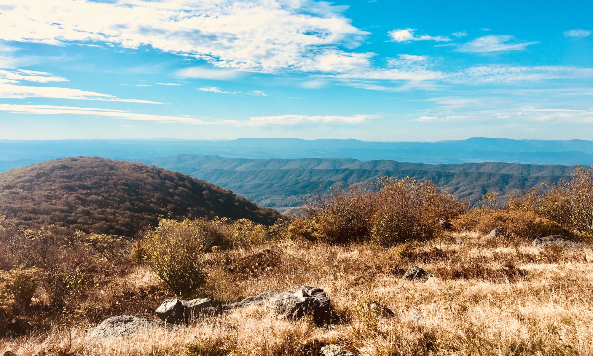
My previous boss, Nancy, recommended the book Desert Solitaire, written by Edward Abbey. Abbey was a park ranger at Arches National Park in 1956 and 1957 (then Arches National Monument), and describes what it was like to work and live in Utah during that time period, a remote and beautiful place. I fell in love with the book, and fanaticized what it would be like to visit Utah while I was reading. Come to find out, much of Utah is still just as Abbey described it. Desolate, remote, windy, hot, and absolutely stunning. But alas, Arches is not the same as it once was. Maybe it was the National Park designation, maybe it was the newly installed well maintained roads, or maybe Abbey was the ultimate downfall. Describing Arches with such beauty that everyone wanted to see it. Who knows. But there are a fuck ton of people here now and I do not like it.  

These views littered Arches NP.

Our first hike was to see Delicate Arch, the most famous arch in the park and supposedly the most beautiful. Delicate arch is featured on Utah’s license plate, so you’ve most likely seen a picture of it. The hike there actually makes me very happy. I know from my research that the trail is exquisitely designed to hide the arch from view until the very end of the hike, where it is instantly exposed all at once. It’s a 1.5 mile hike straight up slick rock with no shade, no water, no benches, no nothing. Watching overweight families trying to scramble up the rock while bitchy kids complained made me oddly happy. Not everything that’s cool should be immediately accessible from a parking lot. You got to work a bit to see this beauty. And it’s obvious that most of these “hikers” are not prepared. I hear people asking “where is the arch?” while hiking. One person asked, “is there a bathroom at the arch?” Um. No.

Kristi didn’t like the trail…
I found it….

Kristi and I get to our destination pretty quick to see there are about 50 folks just hanging out around the arch. Taking pics, absorbing its beauty, and guzzling water from the hike. We stand in line to take a pic with the arch. That was a mistake. Stupid arch. People love their damn arches. We stand for about 15 minutes getting frustrated with tourists taking way too long with the arch, snap a few pics, then head down. PS the hike down was way easier than the hike up.

Kristi and the arch.

Once down, we headed over to the Fiery Furnace overlook. We should have planned our trip a bit better, because the furnace would have been the best hiking option for us. A maze of rock fins and tons of canyons, this place looks wild! But, you need a permit go into this area, and some experience so that you don’t get lost. Sounds like hogwash to me…. I bet too many fat families got lost in the rocks so they had to shut it down. Kristi and I would have figured it out. We decide to leave the overlook and head to the Devil’s Garden, another area Abbey describes in Desert Solitaire.

Fiery Furnace Overlook

Well going to the Devil’s Garden was a mistake. This was like, a highway of hikers. The parking lot was massive and completely full. We hike in to see Portrait Arch, another Arches staple. It was, well, another arch. Cool. I took a picture. We decide to hike back to the car and get out of this overcrowded people zoo. Right outside of the Arches boundary I can see the same damn rock features with no people… I do not understand this place. I go to pee before getting in the car, but Kristi and I hear someone throwing up in the pit toilet. I cannot image anyplace worse to throw up… The heaving sounds make me queasy, so we skip the pee break and just decide to leave. It’s hot, crowded, and smells of vomit.

Landscape Arch

Once we left, we decided to hit up Moab one more time to grab groceries. I’m glad we did! We found a cute little place called Moonflower, and it had awesome fresh local produce, and a plethora or organic snack options. We grab veggies, some sausage, peaches, and organic energy drinks and head out of Moab. I liked Moab. I could see myself visiting here again, but I’d skip Arches and stick to the BLM lands that surround it. We have the GPS set for Dinosaur National Monument, and start our drive only to realize our organic energy drinks are shit.

Not relevant, but look at this poor fish’s face…..

So, I made a mistake when putting Dinosaur NM in my GPS. There are two properties that fall within Dino NM, one in Colorado and one in Utah. The camp site I found was in the Colorado section, so that’s where we headed. We pulled up to the visitor center of Dino pretty late, and get out to see where we can see dinosaur paraphernalia in the morning. In huge letters, as soon as you walk up, there is a sign that says NO DINOSAURS IN COLORADO UNIT OF DINOSAUR NM. Crap. We continue on to our planned camp site in the non-dinosaur section of Dinosaur Monument. The site ended up being absolutely amazing. Alone up on a hill with tons of firewood around. We made sausage and kale over the fire, make cocktails, and listened to the Lore podcast while watching the stars come out over the valley below us. Life is good. Even without dinosaurs.

We were on the road to Echo Park, so FYI, no dinos in that section. You gotta go across the river through Jenson, UT to see the fossils.
Camp spot

The next morning, we tour the non-dinosaur section of the park for a bit, then decide to drive over to the dinosaur section. It’s an hour and a half drive to get to the main area of the park, but we decide it’s worth it. And you know what, it totally was worth it! Walking into the visitor center was awesome, as it had tons of real fossils, replicates of other cool fossils, and lots of dino related things to purchase. Kristi of course goes buck wild buying things for her kids as I peruse the dino fossils around the facility. Once we had seen everything about 4 times, we hopped on the free shuttle to see the quarry.

Non-dino section views were pretty incredible.
Pic with Steggy!! He chills at the visitor center.

So I didn’t know what to expect with this park, but the quarry was amazing! Apparently this area was discovered by a dude named Edward Douglass in 1909 when we saw some dino vertebrae sticking up out of the rock. He collected a shit ton of fossils for the Carnegie Museum of Natural History where they studied them. Now, a National Monument, the quarry was been preserved in situ. Basically, they exposed a bunch of bones in the rock, then built a building around it so that visitors could see the dinos in their final resting place. Pretty damn cool if you ask me, and definitely worth the drive.

Allosaurus skull, apparently 4 intact skulls were found in this quarry.
View of the quarry rock with dino bones.
SOMETHING TICKLED MY NECCCKKK

After the quarry visit, we did an additional drive within the park to see petroglyphs, which ended up being pretty neat. The best one was a ginormous lizard that experts think took an entire month to create. We finish up the driving tour, then set our sights for Steamboat Colorado.

Giant lizard with no scale for you to actually see how big this thing is.
Sure, I’ll paint you, but you’re dick is going to be out….

Yelp led us to Otto Pint, a cool little pizza place with tons of local brews. The place was dead, so Kristi and I sat at the bar and watched Olympic qualifier diving while sipping on beers. Well, cider for her, beer for me. When we got our pizza, it was like we hadn’t eaten in years. We both ate an entire pizza. You know, not like we can keep leftovers… We roll out of Otto Pint, and head into Routt National Forest to find a campsite.

Meadowsss

Routt NF was very alpine for us at around 10,000 feet. The drive into the forest had a herd of elk and beautiful meadows. We found a random pull off with a fire ring and collected wood. The meadow proved to be perfect and cold, a big change from the desert we had been boondocking in.

Cute lil fire.

The morning proved to be much colder than we anticipated, so we packed up quickly and headed into a nearby town to grab coffee and breakfast. The city of Silverthorne turned out to be an adorable mountain town that spoke to us. We got coffee and sat on a bench next to a fast flowing river. Kristi decides she could live in a little mountain town like Silverthorne… Maybe I could too. After food and coffee and calming views, we pack up and head to the Denver Airport. Kristi flies out in the afternoon, so I need to get her there at some point. Preferably before her plane leaves.

As we roll into Denver, we realize we have some time to kill. Kristi remembers there is a wildlife refuge adjacent to the airport (Rocky Mountain Arsenal National Wildlife Refuge), so we plug it into the GPS and head that way. It turned out to be farther than anticipated, but no matter. We’ll at least drop in and see some adorable prairie dogs! As we get to the front gate, we see that it’s closed, and two staff members are turning folks away. We pull up to find out that multiple prairie dogs have tested positive for the bubonic plague, so they closed the refuge. Apparently some prairie dogs had even died recently from it. Not good. We’re sad we can’t visit the refuge, but honestly it worked out because at this point we’re right on time to drop Kristi off. I say goodbye to my Utah buddy, and am once again saddled with the weight of being alone.

Not a great sign….

I decide to visit a Starbucks to get my bearings, use the bathroom, and figure out where in the heck I’m going next. I walk into a location near the airport only to find out they are having a barista competition? The place is packed, there’s a bouncer at the door, and I’m turned away. Cool. I really didn’t want to go there anyway, I’ll just sit in my car and use your WiFi…

I have an old friend that lives in Denver, and she has offered to let me stay at her place while I’m here. I’m initially pretty hesitant. This is a friend I was very close with in college, but I haven’t seen or really even talked to in years. But, she’s an amazing person, so I don’t think she’d want me to be in Denver and not hang out… So I put my social anxiety aside and give her a text, let her know I’m in town, and ask for recommendations of what to do while I’m in town.

I met my friend Jenn freshman year of college. I transferred from Middle Tennessee State University after one semester, and decided to go to the University of Central Florida. Actually, my mom decided I wanted to go to UCF, but that was fine by me. I was pretty apathetic to college at this point. So, I start at UCF in January for the spring semester, and my high school friend Aurora talks me into going to a GLBSU meeting. That’s the gay, straight, bisexual student union. Lot’s of letters…. So I go, but she’s historically a flake and didn’t show up. Typical. I already knew this was a strong option so I wasn’t upset. Just disappointed that I really thought she was going to show up… So I’m at this meeting, and it’s pretty cool. Very inclusive and volunteer heavy. I decide to sign up for an event to make toys for kids in foster care, and while I’m in line the chick in front of me turns around and says, “you look athletic, want to play floor hockey with us?” And thus Jenn was brought into my life. We called her Brunson, and me Manis to avoid confusion. We talk for a bit, and Brunson finds out it’s my birthday the upcoming weekend and I have no friends as I’m at a new school. So of course, in typical Brunson fashion, she creates a birthday party for me with her friends and the rugby team. A person she has just met. I have never felt so instantly loved by a friend ever. It was more than I could ever ask for. And to top it off, I got to learn how to play floor hockey, which I ended up playing during my entire undergrad and graduate degrees.

Jenn and I strapped skateboards on her kayak and did the parking lot rapids.
PS it didn’t work….

Fast forward to today, 15 years later, I’m feeling anxiety about contacting her. That was dumb, because as soon as we met up it was like we never stopped being friends. We talk for a bit, I take a shower, and we head out to a movie showing that she had tickets for. It’s called “Everything is Terrible,” and consisted of 90s and 2000s internet video clips edited to be incredibly fucked up. It was terrible and hilarious at the same time. I loved it. Why can’t Pensacola have more random things like this??

After the terrible movie, we hit up a speak easy named Williams and Graham. I love these types of bars, as they normally are a decent volume and have amazing drink selections. Again, Pensacola, get your shit together. We talk for hours over drinks, then decide we should go back to the house as Jenn has to work in the morning. Oh, right, people have jobs…

Back at the house I opt to sleep in my truck in the driveway. With 4 people in a small space, I don’t want to be in the way and more selfishly don’t want to wake up too early. I say my good nights and hop in the truck.

Ember, Jenn’s dog

I wasn’t planning on staying in Denver too long, but Jenn is trying to get me to stay through the weekend to go camping with her and some friends. I’m sure I’ll figure it out in the morning.

Dino NM

Natural Bridge NM and Canyonlands NP

Upheaval Dome at Canyonlands NP.

Once at Natural Bridge, we find out that it’s basically a driving park. Not too much in the way of hiking, which honestly is good. It’s hot as balls out and we’re both pretty exhausted from yesterday’s adventures. We got water, chatted with the park staff, and began our driving tour. We stopped at some cool arches, took some pictures, then went on our way. Seriously, if you were going to go out of your way to visit just this park, don’t. What is it with people and being in love with arches and land bridges??? We don’t get it…

Bridge
More bridge
Kristi trying to figure out what is so damn interesting about land bridges.

Driving out of Natural Bridge and through Bears Ears again, we stop a few more times at easily accessible locations. One is Salvation Knoll, which is tied to early Mormon explorations. When they were building roads for Mormon passages to the Southwest, a survey group got lost in the dead of winter. A trip that was supposed to take 8 days took like, 23 days. With the last of their food, the men climbed a knoll to see if they could figure out where they were. Alas, Salvation Knoll got its name, as the men were able to navigate back to the others with this new vantage point.

Salvation knoll was stop 11, just east of Natural Bridge NM.

Also on our drive was another Kiva known as the Butler Wash ruins. This was an easy mile walk to an area that overlooked more Anasazi ruins. Not anything you could walk in like Perfect Kiva, but still cool to see.

Butler Wash Ruins, under the overhangs

At this point, we’ve been in the woods for a few days, and we’re looking for some actual food. We roll into Blanding, UT and find that there are actually restaurants here! We pop into a country style burrito shop (don’t ask questions, just roll with it) and I eat so much food it hurts to move. Typical.  After eating too much, we peruse a visitor center and plan out the rest of our day. Looks like we’re headed to Canyonlands National Park. Just so you know, there are three districts to the park. The main attraction is accessible out of Moab and is known as The Island in the Sky district. The southern district is known and The Needles district, and the western section is The Maze district. Just based on the name and on the description from Edward Abbey “Desert Solitaire,” The Maze district sounds right up our alley. Super remote, no facilities, and these huge rock fins that make massive maze-like hikes that either connect to other paths or dead end into canyons or rock cliffs. But…. There is like, a 4 hour drive to get to this section. We can’t justify the crazy additional drive time unfortunately. So we settle for the next best district of The Needles. Less visited than the Island in the Sky, and still promising cool features and hikes. We hop in the truck and head out. On our way, we stop at a cool site known as Newspaper Rock. This was a rock face with lots of petroglyphs visible from early residents. Was it a warning to other tribes? A way to communicate with other travelers? Perhaps the youth were just really bored? Who knows. But it’s pretty cool to see now and ponder.

From Newspaper Rock

Driving up to Canyonlands was as expected. Red rocks, desert landscape, and a few private ranches with huge watering systems in place. The visitor center was closed when we arrived, so we grabbed a map and did a Jen/Kristi run tour of the park. One of the coolest hikes consisted of an old cowboy camp from the early 1900s along with a natural spring and some Anasazi paintings. The rocks here are eroded to look like mushroom tops or toadstools, leaving circular overhangs around the structures. Definitely looks like a Super Mario level. Kristi loves the toadstools for some reason…

Cowboy camp
Fun reverse hand prints.
Toadstool!
The spring hike had ladders!

Next, we went to check out Elephant Hill which is supposed to be a super intense 4×4 trail in the park. It’s described as the most technical 4×4 trail in the state of Utah. Yeah, I’m not trying that out, just want to see it. But as we get closer, I start to worry about if there’s going to be a spot to turn around. So I bitch out and leave early. Don’t feel like getting stuck anywhere so late in the day. Instead, we opt to find a park campsite and do a hike into the back country.

Elephant Hill

The hike we did left out of the campground and ended up being beautiful. The scenery is extremely open and has tons of slickrock structures to give the view depth and color. We hike 2 miles out then turn around and head back to camp. Time for a fire, cocktails, and Lore podcast!

Kristi in the back country.
Open vistas and rock.

The night ended up being great! Beautiful out, even though the stars weren’t too amazing. The moon is starting to get bright again, so our stargazing will be limited for the next few weeks. When we woke up, it was already warm. Man the sun is intense here… We took the early light to tour a few more sections of the park, and then headed to the visitor center to question more park employees.

Camp at Canyonlands Needles District

We pull up to the visitor center and walk in to find a pretty empty room. We find an employee and begin our questioning of the soil crust. Kristi and I are mesmerized by the crust and want more information. Like, if hikers can’t walk on the crust because it kills the cyanobacteria (very sensitive to foot traffic), what impact do all those cows have that BLM lets graze its property? Apparently it’s a huge impact. The crust acts as the glue that holds Utah’s red dust together. This keeps red sediment from becoming airborne during wind events. With the crust gone due to cattle, shitty hikers, or other soil disruption events, this red dust is ending up all over the place. Mostly in Colorado. In fact, they are seeing a direct correlation to red dust ending up on snow in Colorado snow packs, and earlier melt times due to the dark color, which leads to heat absorption. Normally the white snow reflects sunlight, but this new red cover is changing all that. Who would have anticipated that… Probably not BLM.

Don’t Bust the Crust!!

We ask this park employee about crusty, the fun cartoon we have been seeing in some places telling us “Don’t Bust the Crust!” He’s fun, informative, and succinctly tells visitors to not bust the crust. I connect with crusty on a personal level. We find out from this employee that crusty has been discontinued as the higher ups think he’s too juvenile. I don’t agree, but I understand. We leave the visitor center and head towards the other, more popular district of Canyonlands, Island in the Sky. To do this, we have to drive through Moab, then back west to the park. There are only a few bridges across the Colorado River, so that really limits how you can get around out here.

Tiny arch, far away, in Canyonlands.

After a few hours of driving, we end up at Island in the Sky. We stop into their visitor center and get some intel from a super helpful employee. We got about 3 hikes lined up and a few overlooks that are good views of the park. Also, we signed up for a permit to take Shafer Trail, a 4×4 trail that cuts down the face of a canyon and traverses along the Colorado River to Moab. Once we have our permit and hike recommendations, we fill up with water and head out to our first hike.

Hike #1 took us to upheaval dome, a cool little slick rock trail that overlooks some green sediment upheaval. No one really knows how the upheaval happened, but there are some theories. I don’t remember what the theories are… But they do exist.

Sediment upheaval

After that short hike, we did another short hike to Aztec Butte to see an Anasazi granary. This was basically a storage facility for these Native Americans, maybe because they were traveling and needed a stopover, or maybe it was to just hide food and water in storage to keep it away from rival tribes, no one really knows. But it was a cool area, with an awesome view. We hung out for a bit then trekked back to the car.

Aztec Butt!
The granary

The last big stop on our park tour was the Green River Overlook. The park district gets its name because it sits on a large mesa that overlooks the rivers below (The Colorado and the Green River). Looking like an island in the sky… We stop here, take some pics, then head out to Shafer Trail. This trail is stupid intense. It’s literally straight down for about 3 miles. I’m in 2nd gear, but my breaks are still smoking up a storm. You can’t go over a few miles per hour due to the small shitty dirt road conditions and hairpin turns. Cas calls me while I’m making my way down. Which actually worked out to keep me from being scared on this drive. Once we got down the main canyon wall, it was fairly smooth sailing from there.

Green River overlook
Shafer Trail drive
Straight down
We also stopped at an arch. But I don’t care enough to talk about it.

We passed herds of bighorn sheep, awesome river overlooks, and a salt drying facility on our drive. Kristi also wanted to stop and dip her toes in the Colorado. This 35 mile-ish detour took about 2 hours to complete, but I think it was worth it. We roll back into Moab around 6 and make a pit stop at the Moab Brewery and Distillery. Utah is so damn weird. Ok, if you want to sit in the restaurant, you have to order food in order to order a beer. Or, you can sit in the tavern, which is only 21 and up, and just order drinks. Two totally separate rooms in one restaurant. We choose the tavern side, sit down, and order beverages and food. So much food that we both can’t move from the hurt of overeating.

River overlook, Kristi giving me a heart attack.
Shafer Trail
Salt drying area
Big horn sheep

After rolling out of the brewery, we decide to stop at a few of the touristy shops along the main Moab drag for Kristi to buy shit. I try to talk myself into getting a t-shirt, but I just can’t. Once we were done shopping, Kristi decided we needed one more beverage before heading to our campsite. We try to find a local’s place and came up with McStiffy. A hole in the wall joint that had a hole in the wall feel. We sit down, but apparently chose seats next to a guy who showers even less than we do. The smell is overwhelming… We finish our drinks quickly and head out to our campsite near Arches NP.

Pulling up to our camp area was as expected. An open area of desert where people have been parking at. Nothing fancy, no frill, nothing. It’s hot, windy, dusty, and now very sweaty in the truck. I immediately pass out, but Kristi is kept up by another truck that pulls into camp right next to us. The area to camp at was no joke, about 3 acres. A large area. This truck decides to park directly next to us. So the only 2 trucks here are within 20 feet of each other. I sleep through everything, but Kristi is apparently freaking out. Eventually she realizes they have a kid and are just trying to camp for the night… Still kind of creepy.

In the morning, we are woken up by our next door neighbors. They are blaring reggae music at 8am, a 2 year old is wandering around, and a little yappy dog is yelling for no apparent reason. Plus, they are smoking weed, and it’s stealing all of our clean air. We get dressed super quick, brush our teeth, and bolt out of there. We need to do laundry anyway, we’ll just go to town and get coffee there. Anything to get away from these weirdos next to us. We do laundry, get coffee, and head out to Arches National Park. One that has been on my list for a long time!!

Bears Ears Pt. 2

Bullet Canyon

Waking up at Bullet Canyon was great, because we were already where we needed to be for our hike. The weather looked perfect, and we were utterly alone. It doesn’t get much better than this! We load up on water, snacks, and sunscreen before following the GPS down the cliff wall and into the bottom of the canyon. There’s no trail here. All of our info just says to follow the canyon 6.2 miles and then look right. Well, this seems easy before you start hiking, but as you get down there you realize it’s heavily vegetated and tons of pig trails lead you all over the place. But that’s ok, we have a general idea of where we are going and how far. The GPS is amazing so we’re putting a lot of trust into her today.

“Trail”

As we walk we’ve got our heads on a swivel to see if we can find any petroglyphs along the way. We end up finding an additional Kiva pretty early on! We take some pics and keep on hiking. We traverse rocky washes, steep slick rock canyon sections, vegetation, cactus fields, and more loose rock washes until we finally get to where the Kiva should be. We eagerly climb some white slick rock and are greeted with the sight of a real Kiva. So freaking cool! We beeline to the structure and find a route to get inside.

Slick rock climb to the Kiva.
Kiva and structure under a large overhang.

This Kiva was created under a natural rock overhang, so the temp is very comfortable under here. We stumble upon a lock box that’s chained to the ground. I open it to find a BLM folder with tons of information on the Kiva. This one was named “Perfect Kiva” because it was so well preserved. We walk around the walls of the living spaces, admire maize cobs and pottery sherds on the dusty floor. We even climb down into the Kiva with the help of a BLM created ladder. To clarify, the Kiva is just a covered area within the living space that exists here. The Kiva was used solely by the men living here for spiritual worship. Or so the box tells us. There are more pieces of cob and pottery down here, and evidence of fire. They have a pretty sweet smoke control structure built in the Kiva to prevent smoke inhalation by its occupants. The rocks are molded together with mud and plant fiber, giving the whole structure a sturdy feel.

Kristi climbing down into the Kiva.
Tools and maize cobs.
Inside the Kiva.

Kristi and I thoroughly investigate this Kiva and surrounding structures, and count ourselves lucky to be able to visit it. But, we know that it this land is given away with the help of Trump, places like perfect Kiva will not last long. We make sure to leave everything as we found it, and attempted to not touch anything. Mouse droppings are prevalent, and I start singing a little tune I call, “Don’t Die from Hantavirus” to Kristi.

As we leave, we have our sights set on the next Kiva known as Jailhouse Kiva. A little over a quarter mile, and Jailhouse Kiva comes into view. Different, yet similar, it’s like another house in the neighborhood. This one is still under a rock overhang, but it’s smaller and slightly higher on the cliff. A large face-like painting is over the structure, making our search for it fairly easy.

Jailhouse Kiva, with odd painting above.

As we get to the entrance, we see why it’s called Jailhouse Kiva. Occupants there at some point placed thatched plant material over the window, making it look like a prison. Maybe it was to keep bugs out, maybe to keep out birds or rain, regardless, it was pretty neat. This Kiva was not as intact as Perfect Kiva, but still was fun to explore. Again, we tried to not screw anything up by visiting.

Kristi looking for fun things at Jailhouse Kiva.
Wood and mud wall at Jailhouse Kiva.

The hike back to the car from the Kivas seemed easier than the hike out. Maybe it was because we knew where we were going, or how long it was going to take, but it was easy. Except. We ran out of water. We each brought 3 liters, but a 15ish mile round trip hike in the desert was drier than I was expecting. And there was no water to filter for drinking along the way. Oh well. We shared what we had and made it back to the car safely.

Cute little nugget!!

Once we made it back to the truck, we packed up and headed out to another slot canyon that we had seen on multiple websites. Fish and Owl canyons were quick hikes from a trail head and were described as being awesome slot canyons. We’re in! As we pull off on the 5 mile dirt road leading to the canyons, I get a smidgen of phone service! I make a quick phone call to Cas to let her know I’m still alive, then Kristi and I continue on to the canyons.

The road out there looked as if it had rained. Hard. The clay was slick and sticky, making a few uphill sections squirrely as shit for the truck. But we made it with no issues. Once we got there, we found the trail head with pit toilet and car camping areas. We also found a van that has been there for awhile, at least we know it got there before the rain. Man, I hope no one was in the canyon while it rained, probably a flash flood for sure. We take note of the conditions the van is in, and decide to do a bit of hiking ourselves.

Looks like an easy trail, ya?

As Kristi and I start hiking, we realize that our path to get down into Owl canyon, is, well, intense. More intense than I was looking for at 5PM after a 15 mile hike earlier in the day. But, the hope for slot canyons overpowered my good senses, and we trekked straight down about a 500 foot canyon wall.

View from the top of Owl Canyon.
Trekking down.

Ok. This hike sucked. We got lost multiple times, and a flash flood ripped through previously and left huge puddles and running water at the bottom of the canyon. We hiked for about an hour then decided to call it quits. The canyon was beautiful but no slot canyons were visible at all. There were multiple times during this hike that I thought we should turn around but I didn’t listen to my gut. Oh well. No harm no foul I suppose. We started our hike back up to the trail head to start our dinner and camp fire routine.

So much water to navigate around…

Once up at the trail head, we collected firewood and set up for the night. The van that was parked near us remained empty, so we did some investigating. We checked the sign in sheet at the trail head, looked to see if they paid to park, and checked to see if we could see anything in the van that could be a clue. But, with no sign in, no payment, and nothing in sight through the windows, we came up empty handed. And, with no cell service and everything closed for the night, there wasn’t much we could do. We decided to stop by the ranger station in Kane Gulch to report the van to park staff first thing in the morning.

Fire at Owl Canyon.

When we woke up, we packed up and headed out of the trail head. The road was still wet but enough momentum got us through to the paved road. As we pulled into the Kane Gulch ranger station, we see that it’s closed! Do these people ever work?? It’s 10AM on a Thursday…. Oh well.

Our morning at Owl Canyon.

We decide to continue on and visit Natural Bridge National Monument which is nestled within Bears Ears. As we’re driving there, the road is closed for construction. One of those guys with a stop sign is standing there so that traffic can pass through in alternating directions. We get to the stop sign, put the car in park and start passing the time scrolling through pics and looking on the map for where we want to go next. Then, all of the sudden, we hear a car behind us that does not sound like it’s going to stop. The guy with the stop sign jumps in front of the speeding car (not his best decision) and the shitty Nissan Sentra screeches to a halt. The guy makes them get into our lane and wait for the pilot car like everyone else. So now this shit car is right in front of us and we get a show. There is a guy and girl in the car, its packed with garbage, and they look super tweaked out. The guy opens the door and starts chain smoking cigarettes, and the girl gets out of the car and starts jumping around and shaking her body. She then begins to do shitty yoga poses, and back bends right there on the pavement. Child’s pose on the damn asphalt. Every time she stands up, she’s jumping and shaking her body. It starts out as funny, then it just gets sad. Hard to watch honestly. Finally, it’s our turn to go, and the cracked out car looks as if it wants to pass the pilot car…. They don’t thank baby Jesus. As the construction ends, they speed off.

These are the Bears Ears. Allegedly.

So we’re off to Natural Bridge, then we don’t know. We will figure that out eventually.

Zion Pt. 2 and Bears Ears National Monument

Allosaurus tracks on display at Lake Powell Dam.

When we woke up at Eagle Crag trail head, we were greeted with some pretty awesome views. We couldn’t see anything last night, but we enjoyed our morning coffee and tea overlooking the Zion valley. After packing up we started our drive back to Zion NP, but we had to abruptly stop after passing an adorable organic fruit/veggie stand near the park entrance. For $7 we got 2 bags of peaches, 2 huge zucchinis, some squash and an onion. All locally grown. After our fresh food snag, we headed towards the park entrance through the town of Springdale, UT.

Eagle Crag camping.
More camp site views.

Pulling up to Zion midday we knew it would be crowded. I mean, this is a destination park for folks. Don’t ask me why. Driving through town of Springdale there are flashing billboards telling us the park’s lots are full, and to park in town. Fine, I’ll pay $22 to park in town for the day and walk in. Come to find out our paid parking was directly next to the pedestrian entrance, and this park is very well set up to handle foot traffic. This makes me happy. I really wasn’t feeling like getting into a shuttle bus just yet.

Shuttle bus line at Zion NP.

Once inside, we have to ride the park’s shuttle system to get to our destination of Angles Landing. This is a very sought after hike at the park, just trailing in popularity to the Narrows. Basically, it’s a 5 mile up and back trail that is straight up to a razor-thin ridgeline to a peak that was so high, it was thought only angles could land there. Well that and like, a thousand tourist a day. No matter. Kristi is determined to get to the top and I’m determined to get as far up as I can. I’m not afraid of heights, I’m just afraid of falling (thanks Britt…) The last .25 miles are slick rock with a single chain to help hikers crawl up. Now this would be fine in solitary circumstance, but when you throw in hordes of people not really equipped to hike like, elderly folks, children, and the obese, it gets tricky. Everyone thinks they can do this hike. So what happens is that these people who are physically unable or scared shitless grab on to the chain in fear and get in situations where they can’t pass. People going up and down are in a ruthless battle to grip the chain and jockey for position. Then throw in very able hikers trying to fly by these terrified or out of shape folks. Now you have a recipe for people to fall and die. A park ranger told us he’s had 4 experiences just with himself, where people were on their hands and knees crying, unable to get down. Nine people have fallen and died. So, there’s your backstory.

Trail goes to the top of this peak.
Not my picture.

Kristi is fearless and that gives me confidence. We easily hike up the beginning portion of the trail including Walter’s Wiggles. I love this name. A park manager back in the day with a last name of Walter designed this hike and paved the beginning portion which included 21 short and steep switchbacks. Hence the wiggle name. With all this foot traffic it’s probably a good thing this section is paved. The slick rock fares well with heavy use, but vegetated mountain sides deteriorate quickly.

View from halfway up.
Walter’s Wiggles.

Once we were past the wiggles, we started the technical spur of Angels landing. I did a small section of the slick rock/chain shitshow. But, once I got to a cool vantage point looking out at the top of the trail, I decided to call it quits. Throngs of people could be seen summiting, and it did not look fun to me. At all. Kristi pushes on ahead and passes tons of families with crying children on her way to the top. I have to admit me sitting on an overlook made lots of hikers get off track. They’d see me, and hike towards me thinking they reached the top. I started trying to cut people off as I saw them hiking to me, “this isn’t the top! I promise!” Oh well, not my problem I suppose. Many other people had the same idea as me and decided this was high enough and turned around. Once Kristi was done, we quickly descend and decided to cool off in the Virgin River below. Nothing like stripping off your nasty clothes and dipping into a cold ass river after a decent hike. Our swimming conjures over other people to swim with us. Look at us. Trend starters. As we wait for the shuttle back to the visitor center, sopping wet, we stop and chat with a park employee. Kristi really wants to see a condor, and we’re trying to figure out where to go. The employee tells us there is a stop named Big Bend that has a nest visible, and sometimes you can see the adults coming and going from the nest on a rack face. Score! We cross the road and get a bus headed the opposite direction to try and see Big Bend.

View from my stopping point.
Sheer drop off at Angels Landing.

Once there, we didn’t see shit. I didn’t have my binoculars and the weather was starting to turn for the worse. We gave it 15 minutes, then caught a bus going back to the visitor center. We wanted to do maybe one more hike to finish off the day, but the heavens opened and it began to downpour. Screw it, let’s just go back and head out.

Walking out of the park I noticed a sign that said, “laundry and showers available.” Having been many days since our last shower, we inquired. $5 for 5 minutes. We take the bait, shower off, and decide to grab food at the Zion Brewery next door so no one gets hangry. The alcohol rules are so weird here, I know I’ve said that before… But 4% beer on tap just doesn’t have the same pizazz. You can’t drink a %4 IPA and expect it to be good. I tried, it wasn’t.

Clean and back in the car, we head towards our next destination of Paige Arizona. I had scoped out a BLM site online while we had service and steered the truck south. Hey, maybe we can get some real alcohol while in Arizona because Utah sucks so hard! Kristi and I are excited about this prospect. As we drive, we notice the landscape change from red rock desert to whitish yellow desert.

BLM desert site.

We get to our chosen camp site and cross the Arizona border. We only know this because my GPS tells me… There is an old cattle corral here, some cool rock features, and an abundance of absolutely nothing. Nothing except one other minivan with what definitely looks like people doing drugs. Kristi feels uneasy, but we’re fine. They are messed up and we have a shotgun. We’ll win that fight every time! We settle in and collect firewood and the minivan eventually drives off. Sweet sweet solitude…

Pretty empty out here.

Out of nowhere a damn rockslide happens. I seriously think it’s thunder at first, but, no clouds anywhere. Sounded exactly like the glacier falling off. Tons of crumbly rock makes this rockslide hypothesis totally legit so I’m sticking to it. After our rockslide and some intense wood gathering, we have a hot and windy fire while listening to our new podcast Lore. Wait have I mentioned Lore yet? I don’t think so… So, while we were waiting for our canyoneering trip to start at Red Canyon, the girl behind the counter at the gas station told us about a podcast she’s obsessed with. Aaron Mahnke does 20 minute bits about old legends and present day folklore that occurs worldwide. Each podcast tackles a relatively bitesize folklore tale, goes over the history of it, and any pertaining details he can find. It’s pretty fun and only slightly scary. We both end up enjoying this podcast and instantly become hooked. From here on out, our cocktail hours were now podcast Lore cocktail hours. Kristi downloads as many episodes as possible so we always have something to listen to while at camp now.

As we’re drinking coffee/tea the next morning and doing our normal breakfast routine, Kristi stumbles on a bull snake attempting to eat something in a burrow! What fun! We pull out the chairs, grab our breakfast, and proceed to watch him wrangle his prey for the next 20 minutes. He eventually comes up empty handed. Poor guy.

Playing ostrich.

After the snake watch 2019, we leave the BLM property and head to a visitor center to get our bearings. We passed one last night a few miles back, but it was too late to stop. As we arrive this morning, we see that it’s closed! At 9AM on a Wednesday. The hours are so bizarre, and they are closed multiple weekdays. The opposite of luck. At least we can fill water and use an actual toilet. We leave and head into Paige, AZ to see what we can find. As we get into civilization, the first thing we come to is the Lake Powell Dam. I don’t like the idea of dams in general, so we’re not too enthralled with this human structure. We wander into the visitor center, grab a few pics, and try to talk to someone who may know about where we want to go. Bear’s Ears.

Dam
Large Dam.

The people in the center were seriously not helpful. I’m sorry, but if I’m a National Park employee at a place directly next door to another park or monument, I’m going to have at least some knowledge of the place. Just on principle. I know it’s not your direct place of work but shit. It’s literally right down the road. Don’t tell me you have no clue and you’ve never been there. She tells us to go back to the BLM visitor office. The closed one we already stopped at. Yeah, that’s helpful. We leave and decide to do our own research online. We find a cute coffee shop, buy caffeine and get studying.

Fun canyon bridge.

We ask the barista if she’s been to Bear’s Ears or knows what’s fun to do there. Again. Less than an hour away and she has never been there. Interesting… Regardless we found some cool stuff to do and we’re ready to explore. Our first stop within Bears Ears National Monument is a 17 mile driving tour known as the Valley of the Gods. I’ve heard really good things about this location so I’m excited!

Valley of the Gods.

Valley of the Gods was ok. I guess if we wanted to camp here it would be slightly better. There are cool rock structures, and the rock and sand is super red. But honestly that’s it. Hard pass. We finish up the drive and head to our next destination, Bullet Canyon.

Washboard roads and rocks.

Driving to Bullet Canyon meant we had to get up Cedar Mesa. I did not know what this meant until I was faced with an incredibly steep wall with switchbacks carved in it. This would have been fine if.

  1. There was enough room for 2 cars to exist on the driving ledge at one time
  2. There wasn’t a MASSIVE storm bearing down on us.
Waiting for pics from Kristi… I was too scared to snap my own.
This is our photo…

This was horrifying. I was doing everything I could to keep my cool, but this drive was hilariously dangerous with the impending storm. Kristi of course is taking photos while hanging out of the damn window. Typical.

Once up the mesa wall, we are greeted with what we call “high desert.” What does this mean? I have no clue. But it’s relatively cool, there are more trees, and it’s high up. PS this whole place is called Cedar Mesa because the locals thought the most prevalent tree here was cedar. It isn’t. It’s Juniper. I’m going to call it Juniper Mesa.

Kristi and the junipers at Bullet Canyon.

A few miles along the main park road brings us to our destination of Bullet Canyon. We’re going to be hiking here tomorrow to visit two Native American Kiva’s left by the Anasazi. They are a little more than 6 miles down a canyon, only accessible by hiking. Knowing we don’t have enough time to visit tonight, we find a spot overlooking the canyon, start a fire, cook some amazing roadside veggies for dinner, and listen to Lore with cocktails. As we wait, the weather starts to look menacing, and provides an intense light show of lightning. Not a bad night if you ask me.

Veggie goodness.
Camping on the canyon rim, storm is looming….

Oh, I should also mentioned that we learned about “the crust” while here. It’s long lived cyanobateria colonies that live atop the soil out in these parts. It acts as a glue to hold sediment together, but is very fragile to foot traffic. We admire the crust here, and do our best to protect it from our feet.

The crust! It’s aliiiivveeeee

PS this tailhead allows car camping for $5 per person for the week. So $10 for the week for both of us, plus there are pretty decent pit toilets here and tons of firewood. I totally recommend staying here if you’re visiting this awesome property!

Fun flower scouting

Bryce Canyon National Park, Red Canyon and Zion National Park

Natural Bridge at Bryce Canyon

After a good night of sleep for me and a shitty night of sleep for Kristi, we wake up balls early to get to Bryce Canyon National Park before the crowds. We don’t normally wake up early, but I’m glad we did. Especially with how Kristi’s neck is feeling I wouldn’t want her to have to climb in a shuttle bus with a bunch of tourists. Anyway, we get to the park by 8am and find sweet parking at the main amphitheater (sunset or sunrise point, I can’t remember) attraction. Bryce Canyon is basically a huge area of hoodoos and other winds carved rock structures with a tall rim around them. Not a true canyon, but still damn cool. We walk the rim a bit and gaze at the rock structures and decide to do a popular trail named the Queen’s Garden. This entails walking down into the hoodoos, which is exactly what we were looking for. Even though Kristi’s neck is still awful, she doesn’t want to miss out on a cool attraction.

On the rim at Bryce Canyon.

We walk down into the canyon and you know what, it’s pretty ok. Bryce is neat. That’s all I got for it. The hike down was pleasant and the “queen” structure was pretty cool. We hike back out of the fake canyon and stroll along the rim for a bit longer. I decide I want to go see inspiration point which is a steep climb to the highest point of the fake canyon wall. Kristi is in too much pain after the hike out of the queen’s garden, so she decides to just lay down on the trail. She looks like she has died. No one stops to ask if she’s ok. A chipmunk tried to jump on her lifeless body….

From the bottom.
I guess it was pretty cool.

Inspiration point was the best part of the park. There, I said it. Glad I hiked up there because the view was phenomenal. I walked down to find Kristi’s body, kicked away the coyotes gnawing on her arms, and hoisted her up so we could walk back to the car. There’s one other part of the park named “Bristlecone Trail” that I’m dying to see. I want to see a Bristlecone pine so bad, especially after I was denied in California due to snow. We drive uphill to the tallest part of the park, making a few stops along the way.

View from inspiration point.

Once at the Bristlecone Pine area, we get out and start our hike. We’re looking for pines and condors here, and soaking in some decent views. We start the walk and immediately notice that a fire has recently swept through this area. Almost everything is dead. Maybe it was beetle kill as well? I can’t tell and the educational signage is complete shit. We walk the mile loop trying our hardest to pick out a bristlecone pine out of the multiple pine species there. We finally get to one that has a sign saying bristlecone, but it’s dead as a door nail. Too bad. Don’t worry I still took pics.

Dead Bristlecone pine.
Maybe this is a live one?

After our disappointing bristlecone hunt, we head back to the car, and back towards the exit. The best part of the entire park was checking out the endangered Utah Prairie Dog! There was a cute little meadow where they were located so of course we had to stop and say hello. After prairie dog spotting, we stop and get some snacks at a gift shop and head back to our camp spot from the night before. Kristi is in crazy pain so we’re calling it a short day. Going to stay near town so we can pick up her prescription tomorrow morning then head to Zion National Park.

They had their own road sign!

We get back to camp and Kristi has to lay down. I mess around, collect firewood and read for a few hours. Nice to just chill ya know? She eventually gets up and we cook dinner over a fire, have a few drinks, and watch shooting stars for hours.

Found a tiny bit of shade for Kristi to nap in.
Cow friends visited us at camp!

In the morning we wake up early, get muscle relaxers for Kristi, then head to Zion. You know, last night I thought my back tire looked low, but I was on uneven terrain so I couldn’t really tell. Now that we’re on the road and back on pavement, I can tell it’s low. We stop and get gas before getting into the Zion area and I pull out the tire gauge. Yup, low as shit. I do a quick scan and I can see a damn screw in the middle of the tire. There’s my culprit. I do a quick google search and find that there’s a shop about 20 miles away that does tire repairs. Then, Kristi spots that the gas station we’re at rents sand buggies. There are like 30 vehicles outside, they have to have some tools to do simple repairs, right?? Kristi asks the gas station attendant and we get some interesting info.

Kristi: Hey, there’s like, a bunch of vehicles out there. Can we throw some money at whoever fixes them up to patch a tire for us?

Woman at gas station: Oh, they don’t rent those. They are under investigation for fraud and everyone has left town. But, you can drive 5 miles back the way you came and there’s a gas station with a mechanic on duty who can patch you up!

We definitely got the local gossip in about 15 seconds flat… We thank the lady, air up the tire a bit, and head back the way we came to the Sinclair station. We pull in and the folks there are super friendly. The mechanic on duty looks to be about 19, but doesn’t matter. He gets the tire off in about 20 seconds and everything patched up in under 5 minutes. And what do they charge? $12. Cas, do you remember when we had to pay $50 in San Francisco for the same shit??? I do… I tip the kid $20. He has just saved me a lot of time and effort.

In the shop….

So, this gas station is a bit odd, let me explain. When you walk in, there’s a counter with a young lady working behind it selling tours. Jeep tours, canyoneering, hiking tours, all kinds of shit. While we’re waiting for the tire, we start talking to the folks here and learning more about what they are selling. We are super curious about the canyoneering, as it’s what we’ve been into for the past week. But this would include a guide taking us into Red Canyon (apparently a super cool spot) and repelling down multiple canyon walls. Our ears perked up. But, at $170 a person I’m skeptical. Sounds super cool, but this is basically going to eat up the rest of our day.

Kristi jumps in and pays for both of us. She tells me to live a little… She’s the best. We grab a burrito at a local food truck that turns out to be baller. Like, so damn good. We sit, devour our food, and then prep for our canyoneering expedition. We end up hanging out in the gas station talking with the staff and chilling with the locals. We actually had a lot of fun just meeting people here. Once it was time to go, we loaded up in one of the companies modified jeeps and head out to the desert.

Loading up in the jeep.

Our guide was named Carson, and he was an adorable 20-something guy who was easy to talk to. Kristi and I chatted along the jeep trail when we weren’t redlining the engine to get through deep sand. While we weren’t totally excited about the “jeep” part of the tour, it was enjoyable. Especially because I wasn’t driving.

Once at the canyon, we had to hike about a half mile straight up to get to where we would be repelling in. Once there, we step into our harnesses and Carson explains how to repel. Super simple instructions. Basically don’t let go of the rope, and don’t fall over. Easy enough. Kristi goes first over the 100 foot cliff. She gets down no problem. Then, it’s my turn, not as smooth as Kristi but I made it down alive.

Hiking up to the canyon.
Carson setting up the ropes.
Kristi repelling down.

Once in the canyon, it’s cool and moist. Like stepping into a basement. We walk along the tall walls and look for fun things dropped on the canyon floor.  

At the bottom, helping Carson get down the first wall.

We do two more repels in the canyon, each one is totally different and fun and exciting. We really enjoyed it. Once out of the canyon we hike back to the jeep and start the drive back.

She’s a badass.
Love this shot.
Repelling down.

We thank Carson, tip him, then head off to Zion National Park. The problem with Zion is that you can only visit when the park’s free shuttles are operation. Now that it’s already 4PM, we need to be strategic about where we go and what we do so as not to get stranded 8 miles from our truck. We make a game plan to jump on a shuttle and visit The Narrows. If we can get there by 7PM that gives us enough time to hike in a bit, hike back and catch a bus home.

My favorite signage on the bus. Rock squirrel diet!

We end up getting to the narrows a little after 7PM. And PS, if you haven’t heard of the narrows, it’s a canyon with the Virgin River running through it. You basically hike along rocks and water through the canyon. People love this place. It’s THE PLACE to visit when going to Zion. So obviously we have to go see what it’s about.

The Narrows is shit. The hype is wrong. Don’t follow the sheep! If you don’t break your damn ankle walking on these huge ass rocks, the cold ass fast moving water will fuck you up. We hiked for an hour, then turned around and hiked back. We were cold. Wet. And thoroughly disappointed. So glad we came now when it was practically empty and didn’t have to fight a bunch of people to get here. We got back to the truck and headed up to a nearby camp area known as Eagle Crag.

The Narrows
It’s all a lie.
Such a shit hike.

So Freecampsites.net is amazing with details. As I read about this campsite, I knew there were going to be super sketchy roads and tons of signage telling us we’re on private property and no camping allowed. Without this knowledge, I would have turned around pretty early on. But we soldiered on through the dark and creepy handwritten signs until we got to a BLM sign saying we were on public property. Score! We found a campsite with maybe a view? It was dark as shit and quite warm. We settled in and went to bed right away. We had a pretty full day, and we have more adventure planned for tomorrow.

Red Canyon

Grand Staircase Escalante National Monument and Panguitch, UT

Hoodoos at the Devil’s Garden.

After some amazing stars at our illegal campsite (we were stranded so we had to camp), we woke up to find that the wash was pretty much dry and drivable. Which is good news because although we could last a couple of more days here, we don’t want to waste extra days here and miss out on other cool shit. This spot was neat though… I wouldn’t mind staying here the entire 2 weeks Kristi was here, but that would be lame. Moving on…

Our camp spot at Upper Muley Twist.
The drive out.

We started the drive out, but the flash flood moved some stuff around and made the drive out a bit more difficult than the drive in. It was fine though, just needed Kristi to get out and guide me over a few obstacles. But, at the end, success! We were back onto actual dirt roads and headed out of Capitol Reef and into Grand Staircase Escalante National Monument. This monument is huge, and I’m very excited to be here. Mostly because it has a lot of exciting natural resources to explore, but also because Trump is an asshat who has been trying to drastically slim down this National Monument. There is supposedly oil, gas and coal under sections of this monument, and political figures have been trying to allow companies to come in and profit from extraction. This of course pisses me off immensely. As it should piss any American who relishes their natural resources. You can’t make more land… So don’t give our shit away to oil and gas companies!

The lighting seemed legit. Got a lot of mud stuck on her undercarriage.

That tangent will come up many more times in the next few blogs. So buckle up.

Anyway, where was I… Right finally at Staircase Escalante… We drive along the Burr Trail, which is an old route ranchers would lead cattle through this land before it was protected. We find a trailhead named simply “The Gulch,” park, and get ready for a hike. We want to find more slot canyons minus the flash flooding. We walk down the gulch and are confronted with cattle fences and cow poop. Of course this land has cattle grazing. The government bends over backwards to help individual ranchers make money.

Desert canyons realllllly don’t care.

Once we pass the cattle fence, the poop thins out and the scenery turns more natural. We follow the GPS into two different canyons to see if we can explore more slot canyons. The first one is a bit of a dud, but the second leads us on a wild goose chase. It starts looking slot-ish, then makes us climb a steep wall, starts to look slot-ish again, followed by wall…. You get the picture. The rock here is very crumbly, and the climbing is difficult yet rewarding. Eventually we decide this canyon will not be delivering the slots we so desperately want and decide to turn around. As I begin my walk down the first steep wall, I eat shit. Fall on my ass, slide down on my hip, and flop over like a dead fish. Kristi laughs, then offers to help me up. But she can’t because she is crippled.

First canyon ended abruptly.
Taking a break at crumbly canyon.

Once down and out of this canyon, we hike back to the car and decide to go into the town of Escalante. There is food here, plus the visitor center for the monument. We decide to start at the visitor center, and I’m so glad we did. As we pull up, the weather turns for the worse. Hey, we weren’t in a slot canyon this time!! We get in and trap a National Park Ranger who is working the front desk. He is an older man, but a genuinely kind and gentle soul. He knows his shit, and Kristi pulls out her notebook with our written down interrogation questions. We’ve been waiting for someone who actually knows what they are talking about…

  1. Why is it called Grand Staircase Escalante? Well, it’s actually two properties, one called Grand Staircase and one called Escalante. The monument declaration joined multiple properties, hence Grand Staircase Escalante. The staircase portion is the “staircase” effect the geology shows. Starting low at the Grand Canyon, the geology “steps up” all the way to Bryce Canyon at 9,000ft. This is the staircase they are talking about. There is no single feature that looks like a staircase or anything like that.
  2. Why is Trump shrinking the monument and who is the land going to? Well, the areas that are proposed to be removed from the monument are where the coal and natural gas reserves are. The land is being transferred from the National Park Service to BLM, so still owned by the federal government. But, BLM allows a lot more uses on their land, including drilling and fracking. It’s allllll is starting to make sense now.
  3. Where are the slot canyons, and is there any difference between the terms slot canyon, narrows, and gulch? He hands us a map with a multitude of slot canyons, and tells us that all of those terms basically mean the same thing. Erosion of rock by water that creates a narrow passage.
Trump’s modification to the monument.

Satisfied with all of our answers, we thank this ranger profusely and head out to the car. We need food, beverages, and to find a place to camp. We ended up visiting the cutest little grocery store and buying more food than we needed. When checking out, we ask the girl what the deal is with liquor sales, and where we can find actual booze. Ok here’s the lowdown, you can sell normal alcohol content beer and liquor from state sanctioned liquor stores. But, it just so happens to be pioneer day, so all of the liquor stores should be closed. Dammit…. But, this chick tells us to hold on, lemme make a phone call. She calls the outfitter down the street to see if his liquor closet is open. Hold on a second time… Liquor closet? Yes, it’s exactly what it sounds like. A legit closet that can be locked shut, state sanctioned to sell booze. The sign outside his closet says it’s closed, but this guy doesn’t give a fuck. He’ll sell us liquor.

Super cute outfitter that sells booze.

Sweet! So we head to this outfitter’s liquor closet. This place turns out is super cute. Independent outdoor supplier with booze. We instantly fall in love. He even has cider??? Win! I buy IPA, cider and some vodka for us to indulge in. When checking out, we notice “Save Grand Staircase Escalante” stickers at the counter, and throw 2 in our pile to buy. He tells us they are free…This is when Kristi starts asking questions about the monument and why the government is giving away property. This gets the guy, who turns out to be the owner, going on a rant. His business relies on tourism, and no one in the government gives a shit about his business or his economic impact. They just want to make the big oil companies happy. The worst part of it is that it’s not currently financially feasible to extract oil and gas from these super remote areas. Yet. Just businesses looking to make money in the future when it does become feasible.

Sticker made it on the bumper!!

Anyway, we leave with our booze and stickers and head to a campsite on BLM property. This is a very open camp spot with little cover and almost no firewood, but Kristi is a scavenger, so we come up with plenty of burnable material. We had a fantastic fire and too much to drink. It kind of was a good thing because we had to pee multiple times in the night, and the stars were again fantastic.

Found this cute collard lizard!

The next morning we woke up early and headed down to where the park ranger pointed out multiple slot canyons. We were excited to try out our novice canyoneering skills… A 40-minute drive down washboard roads finally brings us to a parking lot for three slot canyons, Peek-a-boo, spooky and dry fork. We take our map and head down to the trail heads.

View while walking down to the canyons.

We decide to start with peek-a-boo, which promises difficult climbs and some tight squeezes. It starts out with a 15 foot rock climb up a sheer wall. Hmmm. We analyze the hand holds, and I start the climb first as I’m taller and can reach the holds easier. Once up, Kristi starts, and I grab her hand and pull her up the last few feet.

Ok this is where shit went wrong. In the process of pulling her up the wall, she tweaked her neck really, really bad. Like, almost needing to throw up it hurt so bad. She can’t hold her head up, and the pain is intense. But, we’ve just started our slot canyon adventure, so there’s no way she’s backing out now.

Oh noooooo….
Walking like a hunchback.

We continue on through Peek-a-boo, climbing up smaller walls and squeezing through tight areas. There’s another family in front of us (French maybe?) so we stop a few times while hiking to let them get in front of us. As we reach the end of the canyon, we turn around to walk back through the slot. The French family tells us that the back of this canyon connects on to spooky gulch, just a mile away. We contemplate doing this, following the family, but decide we’d rather do the canyon again because it was cool. We don’t mind walking and retracing our steps. Plus going downhill through the canyon will be way easier than going uphill.

After getting down off the 15ft ledge through tactical sliding, we head over to spooky gulch, just a half mile walk away. We read that you should “go as far as you can” through spooky gulch but we have no idea what this means. As we continue on, we start to understand. The walls get narrower and narrower, eventually just big enough to shuffle through sideways while holding your bag in one hand. It feels like the Star Wars scene where Luke is caught in the trash compactor and the walls start closing in…

Trying to slide through Spooky
Tight squeeze.
Suck in your belly!

We climb rocks and shimmy through tight spaces until we eventually make it to an area that has had a recent rockslide. We can’t get around or over this rock trap, so we decide to turn around. At this moment, we see our French family friends pop through on top of the canyon. They are looking for a way down… Kristi and I help the young boy get down, and then talk the husband and wife through a different climb. Man I’m glad we didn’t follow them. I would have been scared to squeeze through recently fallen rocks…

Rock slide aka end of spooky gulch.

Once they were down, we started our climb back to the entrance of spooky. I made the mistake of throwing my bag in front of me at one point. I couldn’t carry it through a narrow drop, so I lightly tossed it down a 10ish foot drop that I needed to slide down. What I didn’t expect was my water bladder to burst open inside of my pack, leaving a huge pee spot at the bottom of the drop. Shit. I needed that water…So now I have no water to hike back to the car and Kristi is a damn cripple that can’t straighten her head upright. We are a sight to see. We finally exit spooky gulch and head over to the last, least exciting narrow of Dry Fork.

Almost out of Spooky….

While hiking to Dry Fork, we see some thunderclouds forming. The park ranger we previously interrogated had given us some tips on how to avoid future flash floods. When you see thunderheads forming anywhere in the general vicinity, it’s time to leave the slot canyons and dry washes. We notice the clouds, take a quick gander inside Dry Fork, then high tail it to the car. We were not ready to encounter another flood just yet.

Dry Forks felt pretty wide after squeezing through the other two canyons.

Back at the car, the washboard roads royally fuck with Kristi’s neck. But there’s nothing I can do expect feed her Ibuprofen and Tylenol. We take one detour to the devil’s garden, take a few pics, then head out of Staircase Escalante. It’s starting to rain now. So glad we aren’t in a shitty location again! With Kristi’s neck still giving her serious pain, we try and get her some muscle relaxers to help with her comfort level. She calls her sister in law to have a script called into the nearest drug store that’s open, which happens to be in Panguitch, UT. This small town is an hour and a half away and is only open for another 2 hours. We get gas, snacks, and race over to Panguitch to get Kristi relief.

Hoodoos at Devil’s Garden.
Fun drive to Panguitch.

We get there in plenty of time, stroll in, and see that the damn drug counter is closed!! The store is open, which was very misleading for our online search. Apparently, the drug counter closed at noon…. We buy every type of topical pain relief available and check out disappointed. Here we are at a destination we don’t want to be because of a misleading online store hours. Jerks. We try to make the best of our drive by doing laundry at a nearby RV park. Kristi even takes a shower to try and warm up and stretch her neck. We find a campsite online at neighboring Dixie National Forest and drive into the woods.

Camping at Dixie NF
Kristi just trying to exist.

Our camp spot ended up being amazing. Secluded with views and no artificial lights anywhere close. This provided some amazing star gazing opportunities. Plus, ample firewood allowed us to have constant fires. We like this spot quite a bit, and it’s only a few minutes away from Bryce Canyon NP. Our next stop on the Utah tour.

Salt Lake City and Capitol Reef National Park

Cathedral Valley, Capitol Reef.

Meeting up with Cas’ friend Denise was awesome. She was incredibly easy to talk to, so things went smoothly. We went and got wings (my favorite) and then we scouted out a flight park she’s been wanting to find for a while. It’s basically an open grassy at altitude area where hang gliders take off from. Denise asked one guy who had just landed about how he got into the sport. Apparently, it’s pretty easy, sign up for lessons and buy some gear. Then jump off a damn cliff! In that order of course. We watched the jumpers for a bit, then drove down the hill back to her house. I took an amazing shower, then passed out in a super comfy bed.

Flight Park at SLC, Denise trying to get the perfect pic.

I slept in after Denise left for work the next morning, cleaned out some water bottles, then went to pick up my friend Kristi from the Salt Lake airport. Kristi and I became friends when I first moved up to Panama City. When I was working for the Florida Park Service, I was tasked with overseeing the imperiled beach mouse subspecies that were residing at our parks. This included three federally endangered subspecies, the Perdido Key beach mouse, Choctawhatchee beach mouse, and the St. Andrews beach mouse. Coming from southwest Florida in my previous role, I had no idea what beach mice were or what they needed as far as protection goes. So I set up a meeting with the US Fish and Wildlife Service beach mouse recovery lead to ask some questions and learn me some stuff. Thus Kristi enters my life. She was bringing a captive bred beach mouse to my office to look after for a few hours, and I of course lost my shit. An adorable little whitish brown mouse? And it’s an endangered species?! I love it!! It’s name was Sierra and was old as shit, looking like she was knocking on death’s door. Sierra was formerly part of a captive breeding program at Brevard Zoo. They are kept as a kind of insurance policy just in case another huge storm wipes out Perdido Key, or feral cats become rampant, or some crazy disease takes hold of the island. You get the picture I hope. Anyway, from that moment on Kristi was a huge ally in the conservation world. And even became a friend.

This is actually a Choctawhatchee Beach Mouse, still cute. Picture is from a translocation to St. Andrews State Park.

Fast forward three years from that moment and I’m now living at Kristi’s house in a mother-in-law suite. When this trip started forming in my thoughts, Kristi claimed Utah. Visiting me on my travels was going to be way cheaper than flying out, renting a car, and seeing all these places individually. Hopefully that’s enough backstory…

This sums up our friendship right here….

I pick up Kristi from the airport, and we head out to buy groceries, get my oil changed, and pick up some maps. Being only my second day in Utah, I have not fully figured out the rules here in regards to liquor or alcohol sales. I know they are screwy, but I don’t know just how screwy they are. At the grocery store we look to buy some beer for me and cider for Kristi. Maybe even some hard liquor perhaps? When we get in we see no cider. Does Utah not do cider??? And all of the beer is 4% alcohol by volume. What does that even mean?? I decide to skip the booze and just go for food. We’ll find something else more legit hopefully. With groceries bought and oil changed, we hop into a Seagull’s Book Store which happens to be in the same plaza. Maybe they sell maps? Or a map book? We pop in, and, oh boy. Nope. Just huge amounts of Latter Day Saints (LDS) paraphernalia, huge paintings of Jesus and Joseph Smith, and LDS clothing. In fact, there are literally only a few books being sold here. The book of Mormon, and some supporting book of Mormon text. As soon as I walk in I turn around to leave, but Kristi decides to ask the clerk about map books. Of course they don’t sell them here…. Let’s get out of here! We leave and head over to Barnes and Nobles which of course has exactly what we need.

Should have googled this bookstore before going in……

We decide to head to Capitol Reef National Park that night. There is a free campsite in the Cathedral Valley area of the park, and it’s at some altitude so it should be cooler than the steamy 101 degrees that Salt Lake is currently sporting. We drive three hours south until we get to Dixie National Forest. This is where our pavement ends, and the adventure begins!

About 40 minutes on back roads brings us to our camping destination. A sweet free park service camping area with an amazing view of curtain-like rock structures. This definitely feels like Utah. We pick a spot, gather firewood, then set out to explore our surroundings. They are vast and beautiful, with perfect lighting. We start a fire at camp and pour ourselves a vodka cranberry. This feels like some serious vacation!

First Fire!
Rock curtains!

When we woke up in the morning, we decided to drive into the park, visit the visitor center, and get some hiking in. Everything started out great until I left to drive into the park. I took a wrong turn, leading us onto a road that would eventually get us to where we wanted to go, but in about double the time it should have taken us. But we didn’t know. As we climbed down off the plateau we camped at and into the valley, we were awestruck by the rock structures. We didn’t know we were on the wrong road until we hit a named landmark, the Gypsum Sinkhole. I hadn’t planned to stop here, but I’m glad we did. This was a huge ass terrifying hole in the rock. After some pictures and reorienting ourselves, we drove south (along the wrong road) for another hour and a half. Yeah. That’s a long time on shitty washboard dirt road. While driving we pass three kids in a Chevy Impala. I’m not in 4×4, but there are a lot of high clearance issues on this road. We are impressed they have made it as far as they have.

The sinkhole…
Just a huge ass hole.

Once on actual pavement, we head towards the park to see what Capitol Reef has to offer. We were both super stoked to see park service orchards! You pick! You can eat as much as you want for free in the orchard, and taking it out is 1$ a pound! We gorged on fresh peaches and apricots until we couldn’t eat anymore, and then we picked a few pounds for the road. Best deal everrrrr!!! Why didn’t anyone tell me there were sweet orchards at this park? Apparently, the Native Americans that lived in this area planted the trees originally, and then the Mormons “took over.” I say that with quotes because there is a long history of Mormons being complete shit bags to the Native Americans. Slaughtering their people and stealing cattle. So, it’s no surprise to me that they took this land over for their own use. Assholes.

So many peaches, peaches for me.
Kristi does not seem happy about peach hunting….
Sooooo many apricots!!

After doting on fresh produce for a while, we get to the visitor center to figure out where to go for hikes. It’s starting to thunderstorm out, which isn’t good for desert activities. We hop in, get some maps, and are told that we should not attempt any slot canyon hikes when there is rain potential. Flash floods are a real thing that could kill us. But, if the weather clears up, here’s where you go for sweet slot canyons. We thank the student worker for the maps, fill up our water bottles, and head on our way. We decide to get gas and beer/cider before going into the backcountry and find a gas station just outside the park. Again, 4% beer and no cider. This place is so odd. We fuel up and head back towards the park.

Only in Utah…..

Coming in, we find a Mormon run bakery inside the park. Of course we have to stop, and Kristi buys a tiny peach pie. We devour the pie (made from local peaches) and try to hike off some calories. As soon as we start, lightning hits nearby, scaring us down off the mountain we were attempting to climb. It’s like nature doesn’t want us to exercise… We get back into the car and drive to another trail head to wait out the storm. The second trail we attempted was a land bridge called “natural bridge.” I do not understand why people get so damn excited about land bridges and arches… I mean they are cool, but not that cool… Regardless, we hike to the bridge, take some obligatory photos, then walk back. It’s finally time to get off the beaten path and find a campsite. We drive south, into neighboring BLM property and stop at a trail head named Sheets Gulch. Now, I heard Sheep’s Gulch. Kristi thought it was named after a dude named Steve Sheets. So we called it Steven Sheets Sheep Gulch. Just to cover all our bases.

Ok land bridge…

We walk in the gulch and into some pretty cool narrows until the weather started threatening again. We turned around, not wanting to die by flash flood. On the way back, I almost stepped on the biggest damn scorpion I’ve ever seen….

Scorpion friend!!
Slot canyon in Sheets Gulch.

More driving brought us to Cedar Campground, another free NPS spot that was totally empty. We found a spot, collected firewood, and proceeded to have a great fire and cocktail hour. The next morning, we had plans to do a longer hike known as the upper Muley Twist. This would be a 10-ish mile hike that was only accessible by driving down a 3-mile 4×4 trail. It sounded empty and difficult…. I’m in! We wake up early, eat our oatmeal, and head south.

The trip started with an intense switch back dirt road to get on top of the mesa. This was a little scary but beautiful. Kristi was hanging out of the window taking pics as I was white knuckling the drive. That interaction right there sums up our friendship. Me trying to get us somewhere alive, while Kristi has zero fear, trying to document me freaking out. Once up the mesa, we embarked on our 4×4 trail that was really a dried-up wash. Huge boulders littered the trail, but we managed just fine. Once at the parking area, we did a short hike to get to an overlook (Strike Valley Overlook). Totally worth it. Got some sweet Lion King photos.

Truck found some shade along the 4×4 trail.
Kristi documenting my freak outs.
Strike Valley overlook with lion king pose.

Back at the car, we prepped for our longer hike into Muley Twist canyon. It’s called that because early travelers with mules on this path would watch as the animals had to twist their bodies to get through. Allegedly. We packed lots of water, snacks, the GPS and the written description of the trail before taking off. The weather was clear and hot. This seemed like a perfect day for this hike, and we were ready for it.

Muley Twist Canyon.

The first few miles were easy. Follow the wash and look for tons of arches. Our main goal was to find slot canyons, which this trail promised. The written directions said, “slot canyon bypass” which we took as “take this random super steep trail to the slot canyon.” Alas, we were wrong. Staying along the easy path inside the wash would have led us to the canyon. The trail we took was to “bypass” the cool stuff. Who does that?? Once we figured out our error, we backtracked and entered the narrows. They were cool but super short lived. Oh well, guess we should head back it’s getting late anyway… As soon as that thought crossed my mind, it started to rain. Shit. We couldn’t see any clouds while in the narrow canyon. As we got out of the canyon, it started to pour. Double shit. We decide to scurry back, but we have 5 miles…

Kristi taking some shade in an arch.

Within about 2 minutes of the rain starting, the once dry wash had about 6-12 inches of rushing water. Surrounded by tall, slick rock, we had no option but to tromp back through the flood waters to where we were parked. We’d go to high ground and wait it out, but the lighting was close and constant. Triple shit. Being the tallest out of us, I walked first in the tomato red flood waters. The idea was that I would find the deep holes so Kristi could avoid them. Something chest high on me could mean serious trouble for Kristi’s short ass. So, we trudged on. Lightning everywhere, falling in deep holes, and so much sand in your shoes that it was painful. We thought the rain would let up at some point, but we were wrong. It was constant.

Kristi trying not to die.
So screwed…
Just more water.

It took us an hour and a half to make it back to the car. We had both taken spills that sent us swimming and we were soaked in the red mud head to toe. With our road out completely flooded, we realized we were stranded. Good thing we were prepared to stay the night, or we’d be screwed! We hung up all our wet clothes, toweled off, and made the most of our new island campsite. Hopefully the water will recede by tomorrow morning….

Trying to dry our gear.
This was our “road” out.
At least our camp spot ended up being alright.

The Grand Titty (again), Jackson Hole, WY and Fossil Butte NM

Fossil Butte had some open views.

Finding camping outside of the Grand Tetons was harder than originally anticipated. When we finished our awesome hike, we headed southeast of the park to search for camping at the Bridger Teton National Forest. We rolled up pretty early (in my opinion) in the evening to find that all the legit camp spots were taken. We drove around a bit, but realized we were out of luck. This just happened to be one forest that doesn’t allow dispersed camping. But, as we turned the truck around to leave in defeat, a man stops us and says he has plenty of room for our truck. What luck! We back into the spot next to him and start unloading gear. As we do, three kids ambush us. They are asking every question possible, like, where are you from? Do you live in your truck? Why is it so dirty? Do you like sushi? The questions were random and hilarious. The dad tries to shoo the kids away to give us space but it’s no use. Plus, these kids are actually pretty cool. I think they ranged in age like, 5, 10 and 13. Maybe. Don’t quote me on that. We settle down, get dinner cooked over a fire, and teach the kiddos how to play Farkle. As we play, the dad pulls out a trumpet and begins to serenade us with smooth jazz tunes. Not how I expected the night to end up, but definitely not disappointed! It was so awesome to see this dad taking his three kids on a road trip to see national parks. Being from the deep city of Sacramento, they relished the open spaces and lack of city noise. I know it’s rare to hear this coming from me, but I liked these kids. For the one night. Ok feeling gone.

Not an awful spot to sleep.

In the morning, we wake up at 7AM (no surprise there) and head back into the Grand Tetons. We decide to go to a more secluded area of the park and do a hike in Death Canyon. Going to be honest here, we picked the hike based on the name alone. The same way I pick my beers. This hike ended up providing some sweet bird sightings and some alright views. My favorite was the broad-tailed hummingbirds that seem to be everywhere in the mountains here. We ended up not hiking that far, most of our energy was spent trying to call birds out for FiFi’s camera. And that was just fine with me.

Lake views at Death Canyon.

We left Death Canyon very much alive and headed south to Jackson Hole, Wyoming. Now, all I know about Jackson Hole is that it’s a place where rich pretentious people go. Apparently, lots of famous people have homes here and the cost of living is stupid high. I was reminded of this fact when FiFi and I were looking for a hotel room for the night. We both needed showers and it would be ideal for us to get decent sleep as FiFi has a crazy early flight the next morning. The Motel 6 was $200 a night. When is a Motel 6 ever that much money??? But, FiFi has hotel rewards because she travels so much, which brought our nightly fee down to a reasonable cost.

They apparently love antlers in Jackson?

Funny story, we forgot if we booked the Motel 6 or Super 8… We rolled up at the Motel 8 and the staff there couldn’t find our room. FiFi was about to start throwing shade until she pulled up her email confirmation. Yup, we’re at the wrong business… We walk out laughing, and drive 0.2 miles to the Motel 6 around the corner…

Once checked in, we try and find some decent food in this rich city. All searches lead to Jackson Drug Company, an old school drug store opened in the early 1900s that was re-defined by the owner’s grandchildren. They kept the theme and bones of the place but made it into a popping diner. They kept the original milkshake bar and décor, so it was super cute. We got some amazing burgers and fries, which is just what we were craving.

Diner back in the day. Looks pretty similar still!

After leaving fat and happy, we head back to the hotel room. I feel like a pig, and just want to chill on an actual bed and write some blogs. FiFi decides to go run 6 miles… She’s a god damn beast. Did I mention it’s like 100 degrees outside? Yeah. Beast.

After she gets backs and showers, we decide we need a huckleberry dessert. We have seen so much freaking propaganda for huckleberry in this part of the world we feel brainwashed. Must. Try. Huckleberry…. So we both search on the interwebs for the best Huckleberry shake, cake, ice cream, whatever is best. And what do our searches come up with? Jackson Drug Company. We have no shame, so we went back. But this time we sat at the bar to switch things up. I mean we were getting milkshakes, might as well sit at the milkshake bar. We both order a huckleberry shake as we suck at sharing. When it arrives, we get a full glass with whipped cream cap and cherry topping, plus a metal cup half full with the extra shake. Holy shit what did we just order? This is like 5 million calories, but we don’t give a shit. We both finish every drop of huckleberry goodness and roll out of Jackson Drug Company one last time. Worth it.

Huckleberrrrryyy

The next morning we wake up stupid early to take FiFi to the airport. She has to be there at like 5 or something stupid like that. To my surprise the airport is inside Grand Tetons NP. A public airport inside a park. This is a first for me. It’s small and adorable. FiFi of course gets through security way too early as only 10 people use this damn airport…. I go back to the room to finish planning some stuff for my next trip companion, then get on my way to head south. It’s weird being alone. I’ve been with someone constantly for the past month. This is a shitty adjustment period.

I do laundry in Jackson then drive to Fossil Butte National Monument which is only a few hours south. It’s hot as balls and Wyoming has nothing but rolling hills and farmland. The only exciting part of my drive was crossing into Idaho for about 10 seconds. When I get to Fossil Butte, I head into the visitor center to get my bearings. There are awesome fossils here on display, and a super friendly AmeriCorps chick working the desk. We chat about AmeriCorps and hiking recommendations before I head out into the park. She recommends a lonely hike atop a butte that promises good views and solitude. I’m in.

Best fossil on display!!
The Butt

Ok maybe it was too much solitude, but it was a bit scary. Total mountain lion territory, and no one else apparently hikes this trail. It was poorly marked and overgrown. Some scat was all over the trail, but I can’t tell who it belongs to. About a mile in I hear a strange hissing/huffing noise. Almost like an elephant being punched in the gut. I look over to see a damn pronghorn yelling at me. Ah, this is the poop culprit. I’m totally on his stomping grounds and he’s pissed. But I don’t care. As long as it’s not a damn mountain lion I’m cool. I hike the 3 miles out, take few pics, then head back to the car. I found some neighboring BLM property that has some boondocking sites, so I head north of the park in search of a place to spend the night. I’m greeted with some open country and amazing views. The flies are shitty, but everything else is perfect. I put on a podcast, eat chips and salsa, and watch the sun fall below the arid landscape.

Not much out here.
HUGE DANDELIONS

 After an eerily quiet night, I decide to do some more hiking before heading into Salt Lake City. Leaving my camp site, I woke up about 25 pronghorns. They all yelled at me as I drove by. Sorry for the early wake up guys… But FiFi did this to me for like 10 days straight. I hit one nature trail, then another trail that goes up to an old fossil mine. I have to say, this fossil mine trail is one of my favorite hikes I’ve done. The educational info was on point, and the fossil mine had tons of fossils littered all over the ground. I loved it.

Tiny fish?
More tiny fish?
The first guy to really harvest fossils from here lived in this tiny shack during the summers to be close to the quarry.

Once I was done at Fossil Butte, I headed to Salt Lake City. I’m staying with one of Cas’ longtime friends there for a night before picking up my next companion. I feel like I’m talking about companions like Dr. Who… Anyway, I’m excited for the possibility for a shower and real food.

Sago Lily at Fossil Butte.

Yellowstone and the Grand Titty (Teton)

FiFi spotting a moose at the Grand Tetons

7AM pronto, FiFi wakes me up and we prep to visit Yellowstone NP. We roll into the town of West Yellowstone before entering the park and driving towards our ultimate destination, Old Faithful. As we’re entering the park boundary, there are sooooo many people. Every time an animal is spotted on the road traffic screeches to a halt. I love animals, but they are really starting to annoy me when I see them just lazing around on the roadway posing for pics. Get your media attention elsewhere you assholes! FiFi does not approve of me yelling at the animals.

Our first stop is at a place called mudpots. Sulfuric air is escaping the earth through brown sludge, boiling up and looking as creepy as possible. Also, along this route are some hot springs with alluring blue shades, simmering along to the delight of onlookers. Including us. A buffalo decided to plop down next to the trail so I get my obligatory picture in. After that, we were back in the car and headed to Old Faithful.

Mudpots
Attention whore.
Fun blue water.

This parking lot is massive. I mean, Disney plus Epcot plus Downtown Disney status. We eventually find a spot and head over to the viewing area. This is a large concrete circle around the geyser with multiple rows of benches arching with the sidewalk to allow as many people as possible to watch the geyser from a sitting position. At first I think this is silly, but them I’m very thankful for the seats as we have to wait about 20 minutes for the Geyser to blow. Someone knew what they were doing when they designed this… Old Faithful started out slow, then rose in strength for a minute or so, then fizzled out. Not the biggest or grandest geyser, but she was faithful. And I appreciate that.

Ze old faithful.

After the show, FiFi and I wander among the crowds to check out the visitor center and gift shop. She of course finds a t-shirt and patch, while I stick to getting my National Park passport stamped. We finally decide to leave the crowds and head down to the West Thumb area, which looks to be a tiny volcano caldera inside the larger Yellowstone caldera. There are tons of flashy blue pools here and fun mini mud volcanoes spewing hot air. We enjoy a relaxed amble along the boardwalk, and decide to continue on through the park.  

Blue pool with boardwalk in the background.
More colorful fun hot tubs.
Edge of the West Thumb caldera.

We finally come to some waterfalls and the “Grand Canyon of Yellowstone,” so of course we stop. Some pretty steep hikes lead us to a waterfall viewing platform along with what feels like a million other people. We jockey for position to take photos. This feels stupid… We decide to hike around a bit on the canyon rim to soak in the views. They are magnificent even if they are full of people. It’s windy as all get out up here, so FiFi and I decide to head back to the truck.

Grand Canyon of Yellowstone.

Another point of interest for us was seeing the Grand Prismatic Spring. This is what you see in all of the park literature when you google Yellowstone. It’s supposed to be this awesome huge pool with amazingly colorful bacteria bordering its perimeter. So of course we set our sights on it. First, we decide to do the overlook which consists of climbing a small hit a good distance away and looking down on the spring. Parking is a bitch, but I suppose it was worth it.

Grand Prismatic

After the overlook and lots of shitty people, we decide to walk the perimeter of the Grand Prismatic. But first, we have to locate a parking spot in one of the busiest areas of the park. We end up parking on the side of a busy road and hiking through the woods along a pig trail for far too long. That’s fine though, better than sitting in traffic for 40 minutes to find a spot. We finally pop out among a crap load of people and start our walk around the spring. Tons of cool colors, tons of people, and so many hats! There are about 20 hats blown into the spring…

Water spilling out of the spring.
On the rim. Someone lost their binocs case as well.
It was more cool from the overlook.

After the Grand Prismatic shit show, we head back to the truck. One more stop leads us to an interesting attraction. This boardwalk leads around more geologic features, but buffalo have moved in. A park ranger has closed a section of the walk which ended up stranding many people. They are stuck until this animal moves… With recent news story telling of random buffalo attacks at Yellowstone, I’m glad this dude is here. I’m confident some idiot from Michigan would try to pat this animal on the rump while taking a video and die instantly from a goring incident. Alas, no such goring took place. But I did see my favorite feature of the entire park! Dragon’s mouth spring. The hot water pushing up through water and rock sounds like a legit monster is living underground. Add in steam and rocking water and you have yourself a dragon’s den. Children around here really believe a dragon is lurking below the water. I could be talked into it…

The Dragon’s Mouth Spring

We finally leave Yellowstone through the North, and drive to a sweet BLM camping area in the town of Gardiner. Normally BLM sites are shitty gravel parking lots, but this one was along a large river and had shade and grassy parking. It was perfect! This also allowed me to finally attach my solar panel to the roof using the tools I had with me. Tubing for padding, zip ties, and lots and lots of Gorilla tape. I love both zip ties and Gorilla tape so much…

BLM camping
Solar is up and running!

After a relaxing night, we head into town and grab coffee. This area is so cute, we couldn’t not stop for a bit. Coming into the park again, we were greeted with smaller crowds due to the early start time. We stroll along Mammoth Springs and chase down a Violet-green swallow. Elk are lounging around in the grassy medians, warming up in the early sunlight. Finishing up at Mammoth, we start a drive East when my truck suddenly dies at a stop sign. Like, engine off, all dash lights on, screech to a halt kind of die. WTF? She starts back up fine, and we creep to a parking spot to analyze what just happened. We check the oil, air filter, and tug on all the wires we can find to see what’s going on. Nothing. Everything seems to be in working order. Our next stop is into the heart of Yellowstone, so I’m a bit worried. Worse case scenario I call for help on my GPS, but I’d much rather just not get stranded anywhere. I’m nervous.

Mammoth Springs

But we continue on fearlessly. JK I’m freaking out.

We decide to drive a scenic dirt route and are rewarded with a momma black bear and two cubs. After we decide to take a short hike down to a lake to see if we can spot any cool birds. No crazy cool anything but the views were pretty fantastic. Car is acting totally normal now, so maybe it was just a fluke? We stop at a multitude of other attraction along the main road of the park, including a 3ish mile hike to another cool lake. The wind is kicking, and we’re pretty fearful of a snag falling on us. So many dead trees here, it’s a legit concern. The sound of creaking and logs rubbing together consumes the forest. We gingerly hike through, looking for bears and the hint of tree fall.

Sweet meadow.
Lake at the end of our trail. FiFi trying to fit in with the ducks.
Trail and dead snags. So scary.

After our hike, we head south out of Yellowstone and look for a campground near the Grassy Flats Reservoir within USFS land. We drive for what feels like forever on gravel roads to find almost every available camping spot taken. It’s getting dark, and we’re feeling a bit hopeless. Eventually, a family allows us to share a very large camping spot with them. They do not seem entirely happy to have us there, but they obviously feel bad. We take up as little room as possible and go to bed early. The mosquitoes here are relentless, and we’re doing everything we can to avoid them. Alas, it is impossible to keep them out of the truck. FiFi also found multiple holes in my tent and attempted to patch them with tissue paper. It was pretty awful. No pictures of the shit show.

After shitty sleep, we head out early to the Grand Tetons. We stopped and grabbed coffee at a convenience store, then headed into the park to get some hiking in. We started on a hike to Swan Lake, but the mosquitoes were again awful and the views weren’t worth the time or effort. After about 3 miles we called it quits and headed to another section of the park. We decided to get a longer hike in, so we parked at Jenny Lake, walked around half of it, and up a trail named cascade canyon. This trail passes a sweet waterfall and inspiration point as it winds up a canyon. The uphill was perfectly challenging and offered amazing views of moose along the way. I think we hiked close to 18 miles this day, although I can’t remember the exact number. It was a good day. No complaints. Now off to find a campsite!

Moose! Photo credit Felicia Sawyers
Canyon hike
Jenny with Jenny Lake
Grand Teton views
Grand Teton swimming!

Glacier NP and Missoula, MT

FiFi walking among the nipple flowers
More awesome views.

After our night on slanted ground at the RV camp, we woke up early and headed out to Grinnell Glacier within Glacier NP. Two notes here: 1) FiFi wakes me up at 7am pronto every morning. She ain’t about to waste no time. 2) Grinnell Glacier was a recommendation from my friend Ellen But not Dog. Thank you, Ellen!

At Grinnell Glacier

We get to the Grinnell Glacier parking lot and start our climb up along some of the most beautiful country I’ve ever seen. Seriously. This is the most beautiful place I have been to on this trip thus far. The climate, the vegetation, the bird diversity, it has it all. We pass tons of slow-moving families as we head to our glacier destination. About halfway up, there’s a chain over the trail saying there is ice and snow along the path. Bring crampons and other snow walking equipment. Beware of avalanches. I mean, it’s not saying the trail is closed, just to be careful. We duck under the chain and continue on. Another mile up we get to a gushing waterfall that’s spilling onto the trail. Some folks are attempting to hike under and around the water, but most are just trekking through, trying to not get pushed off the narrow rock ledge by the flow of water. We decide to go the shorter, wetter route of under the falls.

SNOW HAZARD AHEAD

After only one hairy moment we’re through the falls and soaking wet on the other side. We keep hiking. About another half mile up we meet a team of three employee chicks shoveling ice and snow off the trail. They are working hard as hell, shoveling fast and furious. I’m impressed. I crack a joke and tell them I’ll switch for a few minutes and give them a break. I think one girl took me seriously, but decided it was probably a bad idea and went back to shoveling.

Ledge walk under the waterfall

After passing the shovel team, we were faced with a few snow covered paths, and ultimately a steep rocky climb up to the glacier. Once there, we are blown away at how beautiful it is. I mean, it’s half melted and sitting in a pool of its own water, but it’s still amazing. I bet it was even more spectacular just 20 years ago. We sit on a rock a few feet up from the ice and water and begin snacking while stalking birds. While we sit, a chick next to us is jumping into the glacial pool while her friend takes a video and pictures. They apparently just can’t get the angle right, because she has to re-do the jump about 6 times. After the last one, she’s shaking uncontrollably, and all of her exposed skin is red. I’m slightly concerned, but fuck this girl. Who jumps into a god damn glacial pool for an Instagram pic? PS Kenny I know you jumped in too, Amy already told me.

Grinnell glacier with the pool behind us
Dummy jumping into the water

After thoroughly judging this chick on her life choices, and soaking in the amazing view, we start our hike down. The shovel crew has already cleared all of the snow-covered paths. They rocked. After getting down from the hike, we decide to walk around a lake at the bottom to get some different views in and to see if the nearby hotel has a gift shop. FiFi like to purchase patches…. While walking along a paved path, we hear a ruckus coming from the bushes. A grouse is there with chicks, and a three-toed woodpecker nest with two adults hanging out were found in a single square meter of forest floor. What are the odds to have so many cool birds so close to each other! FiFi gets some amazing photos before we continue our walk to the hotel.

Three-toed woodpecker photo cred Felicia Sawyers

The hotel was actually pretty cool. FiFi and I get decently priced coffee and some snacks before heading on to the next area in the park known as Two Medicine. It’s a drive, but seems to be off the beaten path so we’re obviously in. When we get there, we ask a ranger what her favorite hike is, and she answers with an area known as aster meadow. It’s exactly as it sounds, an awesome open meadow with tons of asters blooming. We suit up and head out, looking for whatever is to come. We see beaver, Junco nests, and a sweet waterfall. FiFi decides to get in the water and I initially decide to join in. Fuck it’s cold…. I back out immediately.

Junco nest
I pussed out

Hiking back we hear a western screech owl calling from some spruce trees… We spend way too long trying to call it out with an iPhone app. It doesn’t work. Walking back to the car, FiFi gets an email saying her time sheet was not entered correctly. Shit. We have limited service and have no ability to submit a new time sheet here at the park. We need to drive to a city to get this crap done. We decide to drive to the town of Hungry Horse to get dinner and allow FiFi to get her crap submitted.  The drive was scenic, but long. I was excited to get back into real civilization for a bit, I won’t lie. We pull into a restaurant named Gun Sight and settle in for food, beer and internet access. She gets her stuff done, I talk to my amazing wife for a bit and then we’re off to find a campsite.

Aster meadow views

It’s dark at this point, so we’re trusting a GPS point off freecampsites.net to lead us to camping victory near the Hungry Horse Dam. The point ended up being shit. But we soldiered on through the woods and still found a decent site to camp with and area overlooking the water. It’s just a gravel pit but it’ll do the job of housing us for the night. The next morning we wake up, check out the dam, and head on to Missoula, MT. I need to pick up my new solar panel from Ellen’s house, plus I’m down to hit some cool breweries while we’re there.

I have no idea how it got the name Hungry Horse
Hungry Horse Dam

We pull up to Ellen’s adorable house around lunchtime and are greeted by a cat outside with a tiny harness, bell, and a name tag sporting “Meeko.” I miss my cats so much, so I love being able to get some pets in with Meeko. Ellen is not in town, but a guy watching the animals for Ellen is there and shows us where the solar panel is being housed. I decide to test the panel with the multi-meter and find that she’s running perfect voltage!

FiFi and I struggle to figure out just how in the heck we’re going to affix this new hard panel to the roof. The previous one was mailable and skinny, being affixed with an adhesive. This one either needs to be drilled in, or somehow tied to the roof rack. No matter, we shall figure this out later. We throw the panel in the back of the truck and head off to a place named James Bar (another recommendation from Ellen). I had the most amazing mac and cheese pulled pork sandwich with great beer. Dammit it’s making me hungry now just writing about it…

Oh Missoula

After lunch we head off the Drought House, a brewery in town that I hear Ellen likes. We grab a beer, a gift card for Ellen for helping me so much with this panel, and go to drop off the card at her house. As we go into her house, the guy watching her animals is gone, and her dog is out and on the couch. The dog is apparently afraid of people, and stares at us with bugged out, worried eyes. I give it a treat in hopes of calming its nerves, but it just growls at me… Never breaking eye contact. We plant the card in the fridge and quickly leave the house to head towards Yellowstone.

Draught House

We get to the Yellowstone area pretty late, so we head straight to a camp spot within the nearby National Forest. Everything is wet as it has just rained, but we still decide to scrounge up some wood and try to have a fire. Our dinner plans require us to have a fire, so we’re really hoping we can make this work. We find tons of wood, but it’s large and wet. I pull out a hatchet my sister gave before the trip me and start to hack away at a log, when all of the sudden my wedding wing flies off my wet hand into the grass before me. Fuck. This grass is tall, wet and now covered with wood chipping debris. I throw down the hatchet and start searching for the ring. FiFi follows suit, parting the grass like a chimp looking for fleas or ticks in a neighbor’s fur. I give up in about 10 minutes. Cas and I knew I was going to lose this damn ring. It wasn’t a question of “if” but “when” I would lose it. It’s slightly big when I’m not hiking and easily slips off. I walk over to the fire and start trying to get the wet wood to light. FiFi continues searching, saying she’s not giving up. Well I can’t make her stop, and she claims to be really good at finding lost items…

A couple minutes in of me trying to get this damn fire started, and FiFi announces that she has found my ring! I thought all was lost! But I was wrong! I’m so happy, I don’t even care that the heavens began to unleash a downpour of rain on my crappy little fire. If I can just get it hot enough, it might make it through the rain… FiFi finds a plastic coffee cup in the car, throws it in the fire, and jumps in the car with me. The heat from the plastic burning saved the fire and allows all of our wood to stay somewhat dry. She’s a damn life saver today…

We make dinner, play Farkel (I lost), drink wine, and enjoy the quiet woods. The next morning will be a full Yellowstone exploration day, and I couldn’t be more excited!

Camp with wine, farkel, and FiFi